Hartington Street, Belfast
Introduction
The photograph on this page of Hartington Street, Belfast by Albert Bridge as part of the Geograph project.
The Geograph project started in 2005 with the aim of publishing, organising and preserving representative images for every square kilometre of Great Britain, Ireland and the Isle of Man.

There are currently over 7.5m images from over 14,400 individuals and you can help contribute to the project by visiting https://www.geograph.org.uk
Hartington Street, Belfast
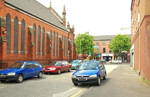
Image: © Albert Bridge Taken: 24 May 2009
Hartington Street ran from Maryville Street to the Dublin Road (background). Much of the area between Bankmore Street and Donegall Pass was redeveloped in the 1980’s. Salisbury Court Image (behind me) replaced the eastern part of the street although there is now a short stretch (behind me to my right) under the name but on a different line from the old Hartington Street.
Images are licensed for reuse under creativecommons.org/licenses/by-sa/2.0
Image Location
Latitude
54.590987
Longitude
-5.932715