
IMAGES TAKEN NEAR TO
Gregg Street, LISBURN, BT27 5AW
Introduction
This page details the photographs taken nearby to Gregg Street, BT27 5AW by members of the Geograph project.
The Geograph project started in 2005 with the aim of publishing, organising and preserving representative images for every square kilometre of Great Britain, Ireland and the Isle of Man.

There are currently over 7.5m images from over14,400 individuals and you can help contribute to the project by visiting https://www.geograph.org.uk
Image Map
Images are licensed for reuse under creativecommons.org/licenses/by-sa/2.0
Notes
- Clicking on the map will re-center to the selected point.
- The higher the marker number, the further away the image location is from the centre of the postcode.
Image Listing (187 Images Found)
Images are licensed for reuse under creativecommons.org/licenses/by-sa/2.0
Image
Details
Distance
1
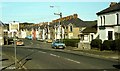
Mercer Street and Gregg Street, Lisburn
Mercer Street (right to left in the foreground) and Gregg Street, in the days before Lisburn became a city (note the pre-Worboys sign “Town Centre” at middle left). This is the Co Down side of the Lagan although the postal address of Lisburn is Co Antrim.
Image: © Albert Bridge
Taken: 11 Sep 1982
0.02 miles
2
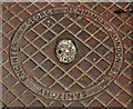
Jennings access cover, Lisburn (2)
Image: © Albert Bridge
Taken: 21 Aug 2011
0.04 miles
3
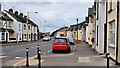
Gregg Street, Lisburn
Gregg Street runs from Mercer Street (behind me) to Canal Street. Mercer Street and Gregg Street can be seen in this view Image taken in 1982.
Image: © Albert Bridge
Taken: 21 Aug 2011
0.04 miles
4
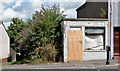
No 63 Gregg Street, Lisburn
A semi-derelict single-storey former shop, about half-way along the northern side of Gregg Street.
Image: © Albert Bridge
Taken: 4 Aug 2013
0.05 miles
5
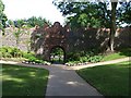
Lisburn Park
Looking towards the walls of the old castle
Image: © Kenneth Allen
Taken: 4 Jul 2008
0.06 miles
7
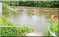
The Lagan in flood (3)
See Image In normal circumstances the Lagan flows from the left across the top of the photograph. The Lagan navigation emerges from the lock Image across the middle. There are public viewing areas, under the water, at the bottom of both sets of steps. Continue to Image
Image: © Albert Bridge
Taken: 17 Aug 2008
0.07 miles
8
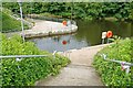
Lock and river, Lisburn
See Image Five days after the heavy rain, which caused widespread flooding, the Lagan had returned to a much lower level. It was now possible to see where the lock ends and the Lagan begins.
Image: © Albert Bridge
Taken: 22 Aug 2008
0.07 miles
10
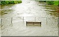
The Lagan in flood (4)
Image: © Albert Bridge
Taken: 17 Aug 2008
0.07 miles