IMAGES TAKEN NEAR TO
Canal Row, NEWTOWNARDS, BT23 7NU

Introduction

This page details the photographs taken nearby to Canal Row, BT23 7NU by members of the Geograph project.

The Geograph project started in 2005 with the aim of publishing, organising and preserving representative images for every square kilometre of Great Britain, Ireland and the Isle of Man.

There are currently over 7.5m images from over14,400 individuals and you can help contribute to the project by visiting https://www.geograph.org.uk

Image Map


Images are licensed for reuse under creativecommons.org/licenses/by-sa/2.0
Notes
  • Clicking on the map will re-center to the selected point.
  • The higher the marker number, the further away the image location is from the centre of the postcode.

Image Listing (151 Images Found)

Images are licensed for reuse under creativecommons.org/licenses/by-sa/2.0
  • ...
Image
Details
Distance
1
A modernised terrace of houses in Canal Row
Some of these units have been converted into commercial units. The one nearest the camera houses S Clarke & Son Funeral Directors.
Image: © Eric Jones Taken: 22 May 2012
0.01 miles
2
The canal, Newtownards (2013-6)
The canal, opposite Canal Row Image, looking downstream.
Image: © Albert Bridge Taken: 17 Jun 2013
0.01 miles
3
Canal Row, Newtownards (2)
See Image Reinforcing of a wall - on the left in the previous photograph.
Image: © Albert Bridge Taken: 7 Sep 2010
0.01 miles
4
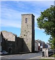
Newtownards Priory
Image: © Dennis Reynolds Taken: 7 Aug 2005
0.03 miles
5
Bench Mark, Newtownards
Cut bench mark located on a wall of the old Dominican Friary in Court Street. This mark dates from the 1st geodetic levelling of Ireland which took place in 1839-43. It consists of a cut mark with a number "8" just to the left. The mark was in a line from Dublin to Belfast which began at Buckingham Lock, Dublin. The original remarks for the mark describe it as: "Newtown Ards Old Church. Mark on wall at side of door; 3.0 feet above surface". It was initially levelled to 21.816 feet above sea level (shown as 21.8 on OS maps of the time - possibly there was also a "21" beside the "8"?).
Image: © Rossographer Taken: 1 Jun 2011
0.03 miles
6
Newtownards WWII air raid memorial
A memorial, close to the main war memorial Image, in memory of those who died in a Luftwaffe raid on Newtownards airfield in 1941. There are two theories. One is that the bombs were a mistake and were meant for Belfast. The other (given to me by one who was serving there at the time of the raid) is that the Germans believed that the nearby (elevated) Scrabo Tower Image and the airfield and were being used to track and attack U-boats in the Irish Sea.
Image: © Albert Bridge Taken: 5 Dec 2012
0.03 miles
7
Government office, Newtownards (1)
A small Department of Agriculture and Rural Development office on the Portaferry Road (Castle Street on the Google map). Architect not recorded but most likely designed by the Chief Architect’s Branch of the Ministry of Finance when TPO Rippingham held the post. Image shows the Royal cypher.
Image: © Albert Bridge Taken: 19 Feb 2012
0.03 miles
8
Government office, Newtownards (2)
The royal cypher GVIR on this building Image
Image: © Albert Bridge Taken: 19 Feb 2012
0.03 miles
9
Clock, Newtownards
Outside a funeral parlour in Court Street.
Image: © Albert Bridge Taken: 7 Sep 2010
0.03 miles
10
No 2A Portaferry Road, Newtownards
Vacant building, on the Portaferry Road Image (Castle Street on the Google map), next to Image (right). Offered for sale and described as “This commercial building has Planning Permission for the demolition of the existing building and erection of 10 apartments with associated car parking and landscaping (X/2008/0033/F), granted 2nd January 2009. Consisting of commercial premises, with offices and warehouse space on a site of c. 0.21 acres, the site is located on the edge of Newtownards Town Centre, in close proximity to the Castlebawn Development and main shopping areas. The property lends itself to either refurbishment of the original building for commercial use, or re-development into residential apartments”. This photograph appears as a matter of record only. I have no connection with any of the parties involved in the sale.
Image: © Albert Bridge Taken: 19 Feb 2012
0.03 miles
  • ...