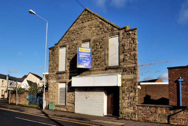
No 2A Portaferry Road, Newtownards
Introduction
The photograph on this page of No 2A Portaferry Road, Newtownards by Albert Bridge as part of the Geograph project.
The Geograph project started in 2005 with the aim of publishing, organising and preserving representative images for every square kilometre of Great Britain, Ireland and the Isle of Man.
There are currently over 7.5m images from over 14,400 individuals and you can help contribute to the project by visiting https://www.geograph.org.uk

Image: © Albert Bridge Taken: 19 Feb 2012
Vacant building, on the Portaferry Road Image (Castle Street on the Google map), next to Image (right). Offered for sale and described as “This commercial building has Planning Permission for the demolition of the existing building and erection of 10 apartments with associated car parking and landscaping (X/2008/0033/F), granted 2nd January 2009. Consisting of commercial premises, with offices and warehouse space on a site of c. 0.21 acres, the site is located on the edge of Newtownards Town Centre, in close proximity to the Castlebawn Development and main shopping areas. The property lends itself to either refurbishment of the original building for commercial use, or re-development into residential apartments”. This photograph appears as a matter of record only. I have no connection with any of the parties involved in the sale.

