
IMAGES TAKEN NEAR TO
Kestrel Park, NEWTOWNARDS, BT23 7EJ
Introduction
This page details the photographs taken nearby to Kestrel Park, BT23 7EJ by members of the Geograph project.
The Geograph project started in 2005 with the aim of publishing, organising and preserving representative images for every square kilometre of Great Britain, Ireland and the Isle of Man.

There are currently over 7.5m images from over14,400 individuals and you can help contribute to the project by visiting https://www.geograph.org.uk
Image Map
Images are licensed for reuse under creativecommons.org/licenses/by-sa/2.0
Notes
- Clicking on the map will re-center to the selected point.
- The higher the marker number, the further away the image location is from the centre of the postcode.
Image Listing (22 Images Found)
Images are licensed for reuse under creativecommons.org/licenses/by-sa/2.0
Image
Details
Distance
1
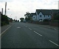
Main Street, Conlig
Looking along the street towards Newtownards direction.
Image: © Rossographer
Taken: 14 Oct 2007
0.05 miles
2
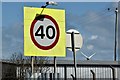
40 mph sign, Conlig (April 2016)
The start of the northbound 40 mph zone, approaching the Green Road traffic lights, on the Conlig bypass.
Image: © Albert Bridge
Taken: 16 Apr 2016
0.08 miles
3
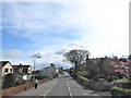
View South along Main Street, Conlig
Conlig Presbyterian Church can be seen on the right.
Image: © Eric Jones
Taken: 17 Apr 2017
0.11 miles
4
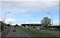
The storage facility of McGimpsey Brothers Removals
This facility is located on the A21 on the urban fringe of Bangor.
Image: © Eric Jones
Taken: 17 Apr 2017
0.12 miles
5
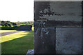
Bench Mark, Conlig
Cut bench mark on the south-eastern tip of Conlig Presbyterian Church.
The mark is 63.01 metres above MSL.
See also http://www.geograph.org.uk/search.php?i=11037856 for many other examples I have found.
Image: © Rossographer
Taken: 14 Jun 2010
0.13 miles
6
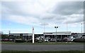
Shaws Citroen at the corner of the A21 and Green Road
Image: © Eric Jones
Taken: 17 Apr 2017
0.13 miles
7
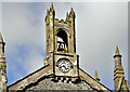
Bell tower and clock, Conlig Presbyterian church (April 2016)
The bell tower and clock on Conlig Presbyterian church Image The church is listed http://appsc.doeni.gov.uk/buildings/buildview.aspx?id=2402&js=false. The description includes “Principal gables have projecting ashlar sandstone verges, rising at the vestibule to a central belfry (with bell) consisting of a clock set into a square base over machicolated mouldings, surmounted by a crenellated bellcote with round-headed apertures and flanked by four angled pinnacles. Walling is greywacke (Scrabo sandstone dressings) built to courses in places, with some snecking, all in lime render. Ashlar sandstone dressings to projecting plinth. Corners have angle buttresses with gableted tops rising above eaves to octagonal pinnacles topped with pointed finials.”.
Image: © Albert Bridge
Taken: 16 Apr 2016
0.13 miles
8
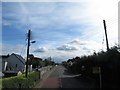
Drooping power lines on Bangor Road, Conlig
Image: © Eric Jones
Taken: 17 Apr 2017
0.14 miles
9
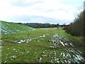
Land surrounding Conlig Reservoir
The remnants of snowmen are evident.
Image: © Dean Molyneaux
Taken: 22 Feb 2010
0.15 miles
10
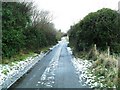
Green Lane, Conlig
A cul-de-sac off Main Street - between the reservoirs.
Image: © Dean Molyneaux
Taken: 22 Feb 2010
0.15 miles