Bell tower and clock, Conlig Presbyterian church (April 2016)
Introduction
The photograph on this page of Bell tower and clock, Conlig Presbyterian church (April 2016) by Albert Bridge as part of the Geograph project.
The Geograph project started in 2005 with the aim of publishing, organising and preserving representative images for every square kilometre of Great Britain, Ireland and the Isle of Man.

There are currently over 7.5m images from over 14,400 individuals and you can help contribute to the project by visiting https://www.geograph.org.uk
Bell tower and clock, Conlig Presbyterian church (April 2016)
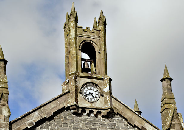
Image: © Albert Bridge Taken: 16 Apr 2016
The bell tower and clock on Conlig Presbyterian church Image The church is listed http://appsc.doeni.gov.uk/buildings/buildview.aspx?id=2402&js=false. The description includes “Principal gables have projecting ashlar sandstone verges, rising at the vestibule to a central belfry (with bell) consisting of a clock set into a square base over machicolated mouldings, surmounted by a crenellated bellcote with round-headed apertures and flanked by four angled pinnacles. Walling is greywacke (Scrabo sandstone dressings) built to courses in places, with some snecking, all in lime render. Ashlar sandstone dressings to projecting plinth. Corners have angle buttresses with gableted tops rising above eaves to octagonal pinnacles topped with pointed finials.”.
Images are licensed for reuse under creativecommons.org/licenses/by-sa/2.0
Image Location
Latitude
54.629494
Longitude
-5.677854