
IMAGES TAKEN NEAR TO
Cuttles Green, NEWTOWNARDS, BT23 5YS
Introduction
This page details the photographs taken nearby to Cuttles Green, BT23 5YS by members of the Geograph project.
The Geograph project started in 2005 with the aim of publishing, organising and preserving representative images for every square kilometre of Great Britain, Ireland and the Isle of Man.

There are currently over 7.5m images from over14,400 individuals and you can help contribute to the project by visiting https://www.geograph.org.uk
Image Map
Images are licensed for reuse under creativecommons.org/licenses/by-sa/2.0
Notes
- Clicking on the map will re-center to the selected point.
- The higher the marker number, the further away the image location is from the centre of the postcode.
Image Listing (16 Images Found)
Images are licensed for reuse under creativecommons.org/licenses/by-sa/2.0
Image
Details
Distance
1
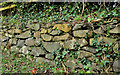
Drystone wall, Comber
A drystone wall, on the Old Ballygowan Road, partly acting as a retaining wall for a residential access road at a higher level.
Image: © Albert Bridge
Taken: 3 Feb 2012
0.02 miles
2
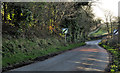
The Old Ballygowan Road, Comber (1)
The Old Ballygowan Road (long replaced by the Ballygowan Road to the west), looking towards Ballygowan, just past the end of the housing developments. It continues, towards Ballygowan, through low and gentle drumlins.
Image: © Albert Bridge
Taken: 3 Feb 2012
0.08 miles
3
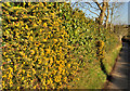
Ivy hedge near Comber (2)
See Image The same hedge, further along the Old Ballygowan Road Image, towards Comber. Still apparently entirely composed of ivy but with some whins intruding.
Image: © Albert Bridge
Taken: 3 Feb 2012
0.12 miles
4
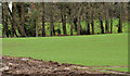
Field, Comber (2)
A field, still undeveloped, on the south western side of Comber, beside the Ballygowan Road Image
Image: © Albert Bridge
Taken: 4 Jan 2012
0.12 miles
5
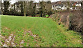
Field, Comber (1)
One of the remaining undeveloped fields on the south western side of Comber. The houses (background) ate on the Old Ballygowan Road. The view is from the present Ballygowan Road Image
Image: © Albert Bridge
Taken: 4 Jan 2012
0.15 miles
6
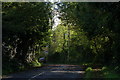
Clattering Ford, Comber
Clattering Ford is a section of the old road left as a loop when the Comber-Ballygowan road was re-built in the 60’s. It takes its name from the stream Image which provided power for Andrews linen mill in Comber. It is not shown on the OS map.
Image: © Albert Bridge
Taken: 28 Sep 2006
0.16 miles
7
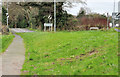
Footpath, Comber
The present Ballygowan Road Image heads off south west (top right) but the footpath follows the old alignment towards Clattering Ford Image
Image: © Albert Bridge
Taken: 4 Jan 2012
0.16 miles
8
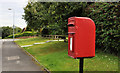
Letter box, Comber
Post-mounted EIIR letter box, on the Carnesure Road.
Image: © Albert Bridge
Taken: 18 Aug 2011
0.17 miles
9
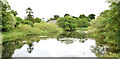
Old mill pond, Comber - July 2014(1)
The north eastern end of the former Andrews mill Image pond beside the Ballygowan Road. Now a bird sanctuary – mainly mallard and coots today. See also Image Image shows the south western end.
Image: © Albert Bridge
Taken: 29 Jul 2014
0.18 miles
10
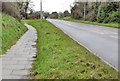
The Ballygowan Road, Comber
The Ballygowan Road (to Ballygowan and Saintfield), just outside the centre of Comber, as it approaches Clattering Ford Image (top left - at the national speed limit sign).
Image: © Albert Bridge
Taken: 4 Jan 2012
0.18 miles