
IMAGES TAKEN NEAR TO
Spinners Court, NEWTOWNARDS, BT23 5WL
Introduction
This page details the photographs taken nearby to Spinners Court, BT23 5WL by members of the Geograph project.
The Geograph project started in 2005 with the aim of publishing, organising and preserving representative images for every square kilometre of Great Britain, Ireland and the Isle of Man.

There are currently over 7.5m images from over14,400 individuals and you can help contribute to the project by visiting https://www.geograph.org.uk
Image Map
Images are licensed for reuse under creativecommons.org/licenses/by-sa/2.0
Notes
- Clicking on the map will re-center to the selected point.
- The higher the marker number, the further away the image location is from the centre of the postcode.
Image Listing (96 Images Found)
Images are licensed for reuse under creativecommons.org/licenses/by-sa/2.0
Image
Details
Distance
1
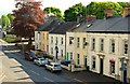
Railway Street, Comber
The railway closed in 1950 but the name remains. This is the view towards the Ballygowan Road.
Image: © Albert Bridge
Taken: 9 May 2009
0.04 miles
2
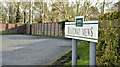
Railway Mews name sign, Comber (February 2016)
The name sign at Railway Mews – a modern cul-de-sac off Railway Street. The railway (now the Comber bypass) followed the line of trees in the background. See also Image
Image: © Albert Bridge
Taken: 8 Feb 2016
0.05 miles
3
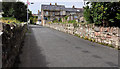
Orange Hall Lane, Comber
A lane running from Railway Street to Brownlow Street Image (background). The original hall seems to have been built in 1875 which might give a clue to the date of the lane’s naming.
Image: © Albert Bridge
Taken: 18 Aug 2011
0.06 miles
4
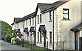
Houses, Railway Street, Comber (January 2017)
See Image Clanmill Housing Association houses facing Railway Street.
Image: © Albert Bridge
Taken: 26 Jan 2017
0.06 miles
5
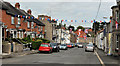
Brownlow Street, Comber
A street, of terrace houses (of different sizes), running uphill from the Glen Road Image (background). For an explanation of the name see Image
Image: © Albert Bridge
Taken: 18 Aug 2011
0.06 miles
6
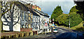
Railway Street, Comber (February 2016)
See Image (May 2009). The northern end of Railway Street from ground level. The Masonic Hall Image is the third building from the left.
Image: © Albert Bridge
Taken: 8 Feb 2016
0.10 miles
7
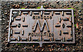
Sirocco water-meter cover, Comber
A rarity and something I’ve been searching for over many months. A water-meter cover, cast by the Sirocco Works, Belfast Image, in Railway Street (Mill Street on the Google map), Comber. In exceptionally good condition, showing little sign of wear.
Image: © Albert Bridge
Taken: 16 Oct 2010
0.11 miles
8
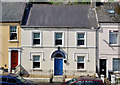
Masonic hall, Comber (2013)
See Image (October 2010). A similar view but taken from an elevated position on the bypass flyover Image
Image: © Albert Bridge
Taken: 21 Aug 2013
0.11 miles
9
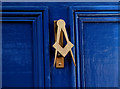
Masonic hall, Comber (3)
See Image The knocker.
Image: © Albert Bridge
Taken: 16 Oct 2010
0.11 miles
10
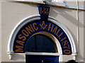
Masonic hall, Comber (2)
See Image The detail around the door, including the date of building and the lodge number – 133. The Ulster Star lodge 133 is one of eight Irish lodges celebrating their 200th anniversary in 2010. Continue to Image
Image: © Albert Bridge
Taken: 16 Oct 2010
0.11 miles