
IMAGES TAKEN NEAR TO
Nairn Court, NEWTOWNARDS, BT23 4LE
Introduction
This page details the photographs taken nearby to Nairn Court, BT23 4LE by members of the Geograph project.
The Geograph project started in 2005 with the aim of publishing, organising and preserving representative images for every square kilometre of Great Britain, Ireland and the Isle of Man.

There are currently over 7.5m images from over14,400 individuals and you can help contribute to the project by visiting https://www.geograph.org.uk
Image Map
Images are licensed for reuse under creativecommons.org/licenses/by-sa/2.0
Notes
- Clicking on the map will re-center to the selected point.
- The higher the marker number, the further away the image location is from the centre of the postcode.
Image Listing (40 Images Found)
Images are licensed for reuse under creativecommons.org/licenses/by-sa/2.0
Image
Details
Distance
1
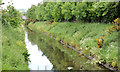
The canal, Newtownards (2013-5)
See Image The view, from the same spot, upstream towards the start of the canal (in the direction of John Street).
Image: © Albert Bridge
Taken: 12 Jun 2013
0.07 miles
2
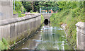
The canal, Newtownards (2013-3)
The view, upstream, from the Carleton Bridge Image
Image: © Albert Bridge
Taken: 12 Jun 2013
0.08 miles
3
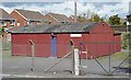
Ards Camera Club, Newtownards
The Ards Camera Club http://www.ardscameraclub.co.uk/ premises facing the Circular Road.
Image: © Albert Bridge
Taken: 13 May 2013
0.09 miles
4

Solar panel and "school" sign, Newtownards
A solar panel powering the flashing lights on a “school” sign on the Circular Road. The school is Regent House Image (background).
Image: © Albert Bridge
Taken: 13 May 2013
0.09 miles
5
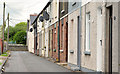
Scrabo View Terrace, Newtownards
A short street (with houses on one side only) running from Raceview Terrace (background) to the canal Image
Image: © Albert Bridge
Taken: 12 Jun 2013
0.10 miles
6
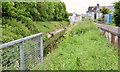
The canal, Newtownards (2013-4)
The view, downstream, towards the Carleton Bridge Image
Image: © Albert Bridge
Taken: 12 Jun 2013
0.10 miles
7
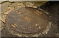
"Smeaton" Selflock manhole cover, Newtownards (1)
A Smeaton “Selflock” manhole cover on the Circular Road opposite Regent House school. I cannot find any internet references to this foundry although the name “Smeaton” is famous in connection with lighthouses http://www.geograph.org.uk/search.php?i=47883450 and the Carron foundry http://www.geograph.org.uk/search.php?i=47883479. Further information very welcome. Image shows the date of casting as 1976.
Image: © Albert Bridge
Taken: 26 Mar 2014
0.11 miles
8
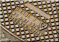
"Smeaton" Selflock manhole cover, Newtownards (2)
See Image Detail from the cover showing the date of casting as 1976.
Image: © Albert Bridge
Taken: 26 Mar 2014
0.11 miles
9
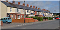
Terrace, Newtownards
A terrace on the western side of South Street. Though mainly rendered, the houses have red brick on the ground floor.
Image: © Albert Bridge
Taken: 13 May 2013
0.11 miles
10
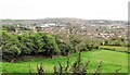
View NNE across Newtownards in the direction of The Whitespots Country Park
The hilly Whitespots area was the location of a major lead mine.
Image: © Eric Jones
Taken: 22 Apr 2017
0.12 miles