
IMAGES TAKEN NEAR TO
Kiltonga Industrial Estate, Belfast Road, NEWTOWNARDS, BT23 4ES
Introduction
This page details the photographs taken nearby to Kiltonga Industrial Estate, Belfast Road, BT23 4ES by members of the Geograph project.
The Geograph project started in 2005 with the aim of publishing, organising and preserving representative images for every square kilometre of Great Britain, Ireland and the Isle of Man.

There are currently over 7.5m images from over14,400 individuals and you can help contribute to the project by visiting https://www.geograph.org.uk
Image Map
Images are licensed for reuse under creativecommons.org/licenses/by-sa/2.0
Notes
- Clicking on the map will re-center to the selected point.
- The higher the marker number, the further away the image location is from the centre of the postcode.
Image Listing (208 Images Found)
Images are licensed for reuse under creativecommons.org/licenses/by-sa/2.0
Image
Details
Distance
1

Parking meter sign, Newtownards (December 2014)
The “please pay here” sign, in the yellow and red colours of the Roads Service (now Transport NI), at a ticket machine in the Mill Street car park. Under the proposals for changes in local government some 145 charged off-street car parks, 227 free off-street and 334 off-street ticket machines will transfer from Transport NI to the new district councils in 2016. I would expect the councils to introduce their own branding on such items.
Image: © Albert Bridge
Taken: 2 Dec 2014
0.02 miles
2
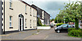
Mill Street Court, Newtownards
Part of a small area of social housing off Mill Street.
Image: © Albert Bridge
Taken: 12 Jun 2013
0.03 miles
3
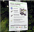
"Parkmobile" sign, Newtownards
A sign at the gasworks car park, Mill Street indicating that the “Parkmobile” facility http://www.parkmobile.co.uk/ is now available at Roads Service car parks in NI.
Image: © Albert Bridge
Taken: 12 Jun 2013
0.04 miles
4
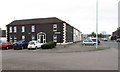
Mill Street Court, Newtownards
This is a social housing development off Mill Street.
Image: © Eric Jones
Taken: 22 Apr 2017
0.05 miles
5
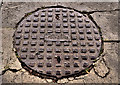
Ulster Foundries manhole cover, Newtownards
See Image A circular version in Mill Street.
Image: © Albert Bridge
Taken: 26 Jun 2011
0.05 miles
6
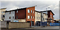
Apartments, Newtownards
Work started on this block of social housing flats in early 2010 Image March 2010. Now nearing completion, it sits between Mill Street (foreground), Gibson’s Lane and Regent Street (background). Also seen in Image April 2010 and Image January 2011.
Image: © Albert Bridge
Taken: 19 Feb 2012
0.06 miles
7
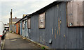
Corrugated-metal buildings, Newtownards
Long-disused corrugated buildings, at the High Street end of John Street Lane. The one nearest the camera still has a faded sign saying “Newtownards Homing Pigeon Club”. The others look like old lock-up garages.
Image: © Albert Bridge
Taken: 30 Sep 2011
0.06 miles
8
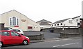
Methodist Community Centre and the Regent Street Presbyterian Church Community Centre in Mill Street
These are located behind the respective main church building which face on to Regent Street.
Image: © Eric Jones
Taken: 22 Apr 2017
0.07 miles
9
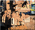
Helical piling, Newtownards
Auger displacement piling at a building site in Mill Street.
Image: © Albert Bridge
Taken: 4 Mar 2010
0.07 miles
10
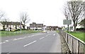
View Southeastwards along John Street, Newtownards
John Street links the Mill Street Round About with the A21 (Comber Road). The tallest building in the background the Newtownards PSNI Ards Divisional HQ. The Newtownards Ambulance Depot is located at the junction.
Image: © Eric Jones
Taken: 22 Apr 2017
0.07 miles