
IMAGES TAKEN NEAR TO
William Street, NEWTOWNARDS, BT23 4AE
Introduction
This page details the photographs taken nearby to William Street, BT23 4AE by members of the Geograph project.
The Geograph project started in 2005 with the aim of publishing, organising and preserving representative images for every square kilometre of Great Britain, Ireland and the Isle of Man.

There are currently over 7.5m images from over14,400 individuals and you can help contribute to the project by visiting https://www.geograph.org.uk
Image Map
Images are licensed for reuse under creativecommons.org/licenses/by-sa/2.0
Notes
- Clicking on the map will re-center to the selected point.
- The higher the marker number, the further away the image location is from the centre of the postcode.
Image Listing (157 Images Found)
Images are licensed for reuse under creativecommons.org/licenses/by-sa/2.0
Image
Details
Distance
1

Nos 2-8 William Street, Newtownards
A terrace (numbered from the left) which also includes no 2 Corry Street (right) Image built using “squared Scrabo sandstone rubble”. Listed and, in the absence of full records, thought to date from around 1840/59.
Image: © Albert Bridge
Taken: 31 Oct 2013
0.00 miles
2

No2 Corry Street, Newtownards
Image: © Albert Bridge
Taken: 31 Oct 2013
0.01 miles
3

Derelict terrace, Newtownards
A long-derelict terrace, in the local vernacular, at the corner of West Street and William Street (background).
Image: © Albert Bridge
Taken: 30 Sep 2011
0.01 miles
4

Church clock, Newtownards
A clock (not working), made by English Clock Systems http://www.englishclocksystems.co.uk/ on Strean Presbyterian church, East Street http://www.geograph.org.uk/search.php?i=44238010.
Image: © Albert Bridge
Taken: 9 Oct 2013
0.01 miles
5
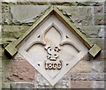
Church datestone, Newtownards
The datestone on Strean Presbyterian church, East Street http://www.geograph.org.uk/search.php?i=44238010 incorporating the date (1866) and the initials “TS” of Thomas Strean who helped to pay for the building of the church.
Image: © Albert Bridge
Taken: 9 Oct 2013
0.01 miles
6
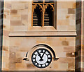
St Mark's clock, Newtownards
St Mark’s (CoI) parish church was built in 1817. It has been suggested that the architect was Francis Johnston whose other buildings include Image and Image A major restoration was completed in 2009.
Image: © Albert Bridge
Taken: 4 Mar 2010
0.02 miles
7
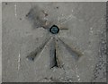
Bench Mark, Newtownards
Bolt bench mark located close to the western entrance of St Mark's Church, Regent Street, Newtownards - Image This mark dates from the initial levelling of Ireland 1839-43. The mark was in a line from Dublin to Belfast which began at Buckingham Lock, Dublin; this is the 276th mark in that line.
The original remarks for the mark describe it as
"Newtown Ards Church. Copper bolt driven horizontally into wall near door; 2.7 ft. above surface".
The mark was originally levelled to 43.168 feet above sea level. Today the mark is levelled 10.51 metres above MSL.
See also http://www.geograph.org.uk/search.php?i=11037856 for many other examples I have found.
Image: © Rossographer
Taken: 1 Apr 2010
0.03 miles
8

View north along William Street, Newtownards
This is a residential street behind the Central Business District (CBD).
Image: © Eric Jones
Taken: 21 May 2012
0.03 miles
9

No22 William Street, Newtownards
Image: © Albert Bridge
Taken: 31 Oct 2013
0.03 miles
10

West Street sign, Newtownards
Cast sign at the William Street end of West Street.
Image: © Albert Bridge
Taken: 9 Jan 2011
0.03 miles