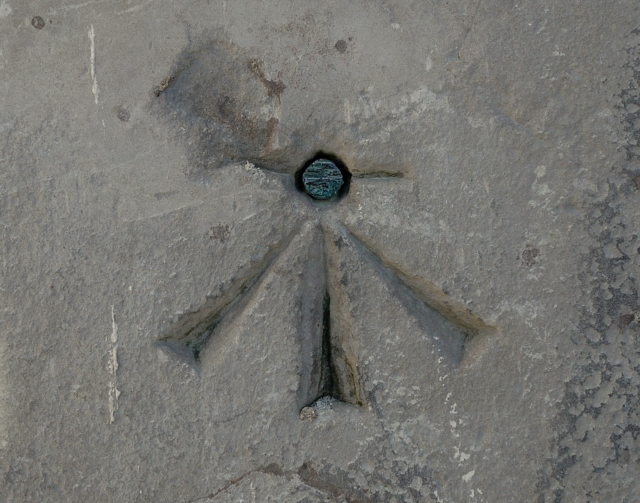
Bench Mark, Newtownards
Introduction
The photograph on this page of Bench Mark, Newtownards by Rossographer as part of the Geograph project.
The Geograph project started in 2005 with the aim of publishing, organising and preserving representative images for every square kilometre of Great Britain, Ireland and the Isle of Man.
There are currently over 7.5m images from over 14,400 individuals and you can help contribute to the project by visiting https://www.geograph.org.uk

Image: © Rossographer Taken: 1 Apr 2010
Bolt bench mark located close to the western entrance of St Mark's Church, Regent Street, Newtownards - Image This mark dates from the initial levelling of Ireland 1839-43. The mark was in a line from Dublin to Belfast which began at Buckingham Lock, Dublin; this is the 276th mark in that line. The original remarks for the mark describe it as "Newtown Ards Church. Copper bolt driven horizontally into wall near door; 2.7 ft. above surface". The mark was originally levelled to 43.168 feet above sea level. Today the mark is levelled 10.51 metres above MSL. See also http://www.geograph.org.uk/search.php?i=11037856 for many other examples I have found.

