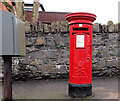
IMAGES TAKEN NEAR TO
New Road, DONAGHADEE, BT21 0DR

Introduction

This page details the photographs taken nearby to New Road, BT21 0DR by members of the Geograph project.

The Geograph project started in 2005 with the aim of publishing, organising and preserving representative images for every square kilometre of Great Britain, Ireland and the Isle of Man.

There are currently over 7.5m images from over14,400 individuals and you can help contribute to the project by visiting https://www.geograph.org.uk

Image Map


Images are licensed for reuse under creativecommons.org/licenses/by-sa/2.0
Notes
  • Clicking on the map will re-center to the selected point.
  • The higher the marker number, the further away the image location is from the centre of the postcode.

Image Listing (53 Images Found)

Images are licensed for reuse under creativecommons.org/licenses/by-sa/2.0
  • ...
Image
Details
Distance
1
New Road, Donaghadee
Looking up New Road from the junction with the Warren Road.
Image: © Rossographer Taken: 22 Mar 2008
0.05 miles
2
Bennetts Avenue, Donaghadee
Part of a street running from the New Road to East Street. The background is dominated by The Moat Image and the Church of Ireland Image
Image: © Albert Bridge Taken: 22 Feb 2011
0.07 miles
3
"The View", Donaghadee (August 2017)
A new apartment development at the corner of New Road and Shore Street/Warren Road. The agents’ description includes “7 Exclusive apartments with uninterrupted sea views Ranging from c. 920 sq ft to 1380 sq ft 2 and 3 bedroom Penthouses with private roof gardens and feature vaulted ceilings”. This photograph appears as a matter of record only. I have no connection with the development and cannot enter into correspondence.
Image: © Albert Bridge Taken: 3 Aug 2017
0.08 miles
4
The Moat, Donaghadee
Built c1818 the Moat housed explosives for the blasting involved in the construction of the harbour. The original mound was of Norman origin, when a motte and bailey stood on the site. It was initially used as a defensive structure, and provided an excellent look-out post.
Image: © Rossographer Taken: 21 Aug 2008
0.08 miles
5
The Moat, Donaghadee
The Moat from the A48 Moat Street, Donaghadee.
Image: © Sue Adair Taken: 26 Feb 2008
0.09 miles
6
Postbox, Donaghadee
Elizabeth II postbox on the Warren Road in Donaghadee (BT21 309).
Image: © Rossographer Taken: 21 Nov 2009
0.09 miles
7
View north along Shore Street, Donaghadee
The large building in the centre of the photograph is Shore Street Presbyterian Church.
Image: © Eric Jones Taken: 28 Mar 2017
0.10 miles
8
Donaghdee and the Copeland Islands from the Moat
A view over part of Donaghadee from the Moat - see Image The stretch of water is the Copeland Sound - the Copeland Islands can be seen beyond. The ship making its way through the sound is the 'Ben Varrey' (see Image). See also Image and Image for related images.
Image: © Rossographer Taken: 21 Aug 2008
0.10 miles
9
Pillar box, Donaghadee
See Image The same EIIR pillar box, on the Warren Road, close to the Coastguard Cottages. Unlike many, this one faces the road.
Image: © Albert Bridge Taken: 22 Feb 2011
0.10 miles
10
Street sign, Donaghadee
Enamel street sign on the Warren Road in Donaghadee.
Image: © Rossographer Taken: 21 Nov 2009
0.11 miles
  • ...