The Moat, Donaghadee
Introduction
The photograph on this page of The Moat, Donaghadee by Rossographer as part of the Geograph project.
The Geograph project started in 2005 with the aim of publishing, organising and preserving representative images for every square kilometre of Great Britain, Ireland and the Isle of Man.

There are currently over 7.5m images from over 14,400 individuals and you can help contribute to the project by visiting https://www.geograph.org.uk
The Moat, Donaghadee
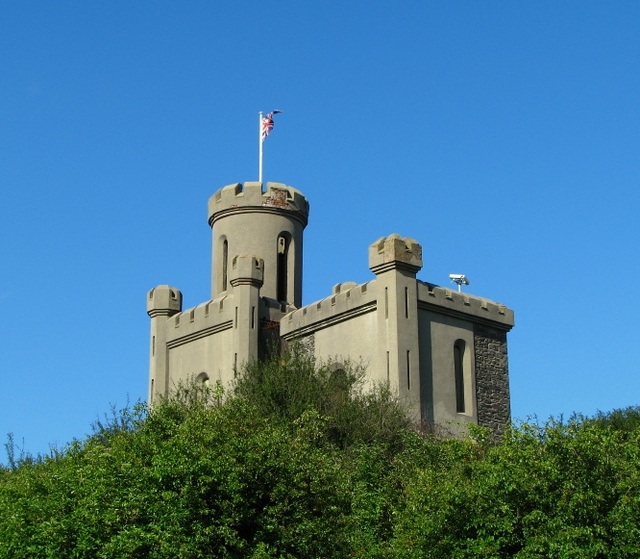
Image: © Rossographer Taken: 21 Aug 2008
Built c1818 the Moat housed explosives for the blasting involved in the construction of the harbour. The original mound was of Norman origin, when a motte and bailey stood on the site. It was initially used as a defensive structure, and provided an excellent look-out post.
Images are licensed for reuse under creativecommons.org/licenses/by-sa/2.0
Image Location


Leaflet Map data © OpenStreetMap
Latitude
54.645266
Longitude
-5.543707