
IMAGES TAKEN NEAR TO
Church Lane, DONAGHADEE, BT21 0AJ
Introduction
This page details the photographs taken nearby to Church Lane, BT21 0AJ by members of the Geograph project.
The Geograph project started in 2005 with the aim of publishing, organising and preserving representative images for every square kilometre of Great Britain, Ireland and the Isle of Man.

There are currently over 7.5m images from over14,400 individuals and you can help contribute to the project by visiting https://www.geograph.org.uk
Image Map
Images are licensed for reuse under creativecommons.org/licenses/by-sa/2.0
Notes
- Clicking on the map will re-center to the selected point.
- The higher the marker number, the further away the image location is from the centre of the postcode.
Image Listing (241 Images Found)
Images are licensed for reuse under creativecommons.org/licenses/by-sa/2.0
Image
Details
Distance
1
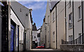
Church Lane, Donaghadee (1)
Church Lane runs from the Cannyreagh Road Image (passing close to the church Image) to High Street Image and Image (background). Narrower at the High Street end. See also Image
Image: © Albert Bridge
Taken: 12 May 2011
0.01 miles
2
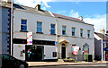
Nos 21 & 19 High Street, Donaghadee (August 2013)
Two vacant building at the north western end of High Street - the former Northern Bank (21, left) Image with a “sold” sign and the one-time police barracks (19) Image with a “for sale” sign.
Image: © Albert Bridge
Taken: 7 Aug 2013
0.01 miles
3

"The Bridewell", 19 High Street, Donaghadee (November 2014)
See Image Now boarded-up and without the “for sale” sign. A plaque records that it was once a RIC (Royal Irish Constabulary) station (strictly a barracks) and “Bridewell” (or lock-up) http://en.wikipedia.org/wiki/Bridewell_Palace , later becoming a post office. Thought to have been built circa 1800/10. The building is both listed and on the “at risk” register.
Image: © Albert Bridge
Taken: 29 Nov 2014
0.01 miles
4

High Street, Donaghadee
Looking up High Street on a bright afternoon.
Image: © Rossographer
Taken: 21 Aug 2008
0.02 miles
5

Former Northern Bank, Donaghadee (November 2014)
See Image The former Northern Bank at 21 High Street – still vacant and with a “sold“ sign. The various bits of surviving advertising are for the Northern Bank showing that it closed before the adoption of the “Danske” trading name.
Image: © Albert Bridge
Taken: 29 Nov 2014
0.02 miles
6
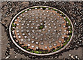
Frederick Bird manhole cover, Donaghadee
A manhole cover, in Church Lane Image, bearing the inscription: “Fredk Bird & Co, Gt Castle Street, Regent Street, London”. The foundry seems to have produced a number of products including fountains and coalhole covers – further information welcome.
Image: © Albert Bridge
Taken: 12 Aug 2011
0.02 miles
7

Butchers Van, Donaghadee
A nice old van belonging to a local butcher in Donaghadee. Parked in High Street.
Image: © Rossographer
Taken: 21 Aug 2008
0.03 miles
8

Former Town Hall, Donaghadee (2013-1)
See Image (August 2008). Today’s view of the building. It has an agents’ “V” board offering it “to let . . . . completely refurbished”. This photograph appears as a matter of geographical and historical record only. I have no connection with anyone involved in the letting. Image shows one of the chimneys. Continue to Image
Image: © Albert Bridge
Taken: 7 Aug 2013
0.03 miles
9
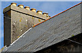
Former Town Hall, Donaghadee (2013-2)
See Image Six surviving pots at the north western end of the building. There is a similar chimney at the other end but now without the pots. Assuming that the two were identical, the former town hall was heated by twelve coal fires which must have needed quite a bit of effort in the winter months.
Image: © Albert Bridge
Taken: 7 Aug 2013
0.03 miles
10

Former Town Hall, Donaghadee (August 2016)
See Image Still vacant and now with the ground-floor windows boarded up.
Image: © Albert Bridge
Taken: 7 Aug 2016
0.03 miles