IMAGES TAKEN NEAR TO
Groomsport Road, BANGOR, BT20 5LW

Introduction

This page details the photographs taken nearby to Groomsport Road, BT20 5LW by members of the Geograph project.

The Geograph project started in 2005 with the aim of publishing, organising and preserving representative images for every square kilometre of Great Britain, Ireland and the Isle of Man.

There are currently over 7.5m images from over14,400 individuals and you can help contribute to the project by visiting https://www.geograph.org.uk

Image Map


Images are licensed for reuse under creativecommons.org/licenses/by-sa/2.0
Notes
  • Clicking on the map will re-center to the selected point.
  • The higher the marker number, the further away the image location is from the centre of the postcode.

Image Listing (70 Images Found)

Images are licensed for reuse under creativecommons.org/licenses/by-sa/2.0
  • ...
Image
Details
Distance
1
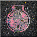
Air valve cover, Bangor
What appears to be an air valve cover on the Groomsport Road in Bangor. The cover is of a very similar size to Belfast Water Works covers such as Image
Image: © Rossographer Taken: 17 Apr 2012
0.02 miles
2
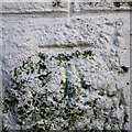
Bench Mark, Bangor
Cut bench mark located on a wall on the Groomsport Road in Bangor. The mark is 8.64 metres above MSL.
Image: © Rossographer Taken: 17 Apr 2012
0.04 miles
3
Bench Mark, Bangor
Cut bench mark on the Donaghadee Road in Bangor. There are two cut marks - perhaps the first was not quite accurate enough. The mark is 11.86 metres above MSL. See also http://www.geograph.org.uk/search.php?i=11037856 for many other examples I have found.
Image: © Rossographer Taken: 13 Mar 2010
0.05 miles
4
View east along Donaghadee Road, Bangor
The junction on the left is the one with Groomsport Road.
Image: © Eric Jones Taken: 17 Apr 2017
0.06 miles
5
Flower beds at the junction of Groomsport Road and Donaghadee Road
Image: © Eric Jones Taken: 17 Apr 2017
0.06 miles
6
Bench Mark, Bangor
Cut bench mark on a gatepost on the Donaghadee Road in Bangor, very close to the corner of Mansleton Park. The mark is 12.11 metres above MSL. See also http://www.geograph.org.uk/search.php?i=11037856 for many other examples I have found.
Image: © Rossographer Taken: 13 Mar 2010
0.06 miles
7
Old electricity box, Bangor
Another of the old electricity boxes found in Bangor. This one is on Waverley Drive. Again marked 'Borough of Bangor Electricity Department'. Made by Johnson & Phillips Electrical Engineers of London. Unlike other examples in the town, this one has been painted green. See also http://www.geograph.org.uk/search.php?i=9637907 for some related images.
Image: © Rossographer Taken: 17 Apr 2012
0.06 miles
8
Street sign, Bangor
Street sign on Waverley Drive in Bangor. Probably original and dating from c1930, this is a cast iron sign, painted and mounted on wood. There are quite a few similar examples in the town, but many have been lost.
Image: © Rossographer Taken: 17 Apr 2012
0.07 miles
9
Beverley Hills, Bangor
One of several areas in Bangor named after famous American streets. Beverley Hills was developed around the 1920s/1930s, coinciding with the American cinematic influences of the age. Marcus Patton http://www.worldcat.org/isbn/090045752X records that "the road was developed on the line of a lane that originally led to the farm of Samuel Johnson, whose wife Amy was a devotee of the silver screen".
Image: © Rossographer Taken: 20 Jun 2009
0.07 miles
10
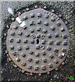
Manhole cover, Bangor
Manhole cover located on the Groomsport Road in Bangor. Marked 'Belfast' and with the letters 'BCC' but no foundry name. Possibly a cover originally destined for the streets of Belfast - BCC may have stood for Belfast City Corporation.
Image: © Rossographer Taken: 17 Apr 2012
0.09 miles
  • ...