
IMAGES TAKEN NEAR TO
Holborn Lane, BANGOR, BT20 5GA
Introduction
This page details the photographs taken nearby to Holborn Lane, BT20 5GA by members of the Geograph project.
The Geograph project started in 2005 with the aim of publishing, organising and preserving representative images for every square kilometre of Great Britain, Ireland and the Isle of Man.

There are currently over 7.5m images from over14,400 individuals and you can help contribute to the project by visiting https://www.geograph.org.uk
Image Map
Images are licensed for reuse under creativecommons.org/licenses/by-sa/2.0
Notes
- Clicking on the map will re-center to the selected point.
- The higher the marker number, the further away the image location is from the centre of the postcode.
Image Listing (1602 Images Found)
Images are licensed for reuse under creativecommons.org/licenses/by-sa/2.0
Image
Details
Distance
1
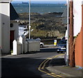
Well Road, Bangor
This little road runs from Holborn Avenue to the Seacliff Road (seen beyond).
Image: © Rossographer
Taken: 5 Apr 2008
0.01 miles
2
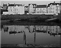
Reflections in the 'Long Hole' [4]
More of the Seacliff Road reflected in the waters at the 'Long Hole' http://www.geograph.org.uk/search.php?i=2783545 in Bangor
Image: © Rossographer
Taken: 30 May 2008
0.01 miles
4
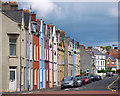
Victoria Road, Bangor
The upper section of Victoria Road, Bangor. The terraces on the left were built c1890.
Image: © Rossographer
Taken: 11 Jul 2010
0.01 miles
5
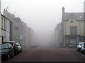
A foggy Bangor morning
Looking along Victoria Road in Bangor early on a very foggy morning.
Image: © Rossographer
Taken: 3 Apr 2009
0.02 miles
6
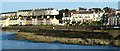
The 'Long Hole' and the Seacliff Road
A panorama view of the seaward side of the 'Long Hole' http://www.geograph.org.uk/search.php?i=3659819 with the houses of the Seacliff Road behind.
Image: © Rossographer
Taken: 12 Sep 2008
0.02 miles
7
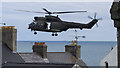
RAF Puma helicopter, Bangor
Royal Air Force Puma Mark II helicopter coming in to land at the 'Long Hole' in Bangor; it was here as part of the 2017 Armed Forces Day and 'Sea Bangor' festival.
Image: © Rossographer
Taken: 25 Jun 2017
0.02 miles
8
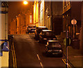
Holborn Avenue, Bangor
Night view of the western end of Holborn Avenue in Bangor. The road ends in a steep slope as it meets the Seacliff Road. See Image for a view in the opposite direction.
Image: © Rossographer
Taken: 10 Jan 2013
0.02 miles
9
![Stormy seas [1]](https://s2.geograph.org.uk/photos/62/58/625834_1542c224_120x120.jpg)
Stormy seas [1]
I spoke to soon in Image
2nd December saw strong northerly winds and rough seas.
Image: © Rossographer
Taken: 2 Dec 2007
0.03 miles
10
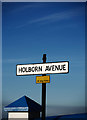
Street sign, Bangor
Street sign at the northern end of Holborn Avenue in Bangor.
Image: © Rossographer
Taken: 14 Jun 2010
0.03 miles