
IMAGES TAKEN NEAR TO
Bryansburn Lane, BANGOR, BT20 3TT
Introduction
This page details the photographs taken nearby to Bryansburn Lane, BT20 3TT by members of the Geograph project.
The Geograph project started in 2005 with the aim of publishing, organising and preserving representative images for every square kilometre of Great Britain, Ireland and the Isle of Man.

There are currently over 7.5m images from over14,400 individuals and you can help contribute to the project by visiting https://www.geograph.org.uk
Image Map
Images are licensed for reuse under creativecommons.org/licenses/by-sa/2.0
Notes
- Clicking on the map will re-center to the selected point.
- The higher the marker number, the further away the image location is from the centre of the postcode.
Image Listing (368 Images Found)
Images are licensed for reuse under creativecommons.org/licenses/by-sa/2.0
Image
Details
Distance
1
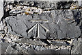
Bench Mark, Bangor
Cut bench mark at the bottom of a wall around a house on the Bryansburn Road in Bangor. Located approximately 20 metres east of the junction with Farnham Road.
See also http://www.geograph.org.uk/search.php?i=11037856 for many other examples I have found.
Image: © Rossographer
Taken: 7 Mar 2010
0.02 miles
2
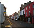
Grays Hill
Looking up towards the Bryansburn Road.
Image: © Rossographer
Taken: 24 Oct 2007
0.03 miles
3
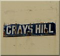
Street sign, Grays Hill, Bangor
Another example of an enamel street sign in Bangor. See http://www.geograph.org.uk/search.php?i=2806784 for other examples.
Image: © Rossographer
Taken: 2 Jun 2008
0.04 miles
4
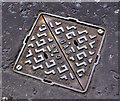
Brickhouse access cover, Bangor
A Brickhouse “Victor” access cover on a gas main at the Brunswick Road end of the Manse Road. This link http://www.geograph.org.uk/search.php?i=22301408 shows other products, on Geograph, from the same foundry.
Image: © Albert Bridge
Taken: 14 Jun 2011
0.05 miles
5
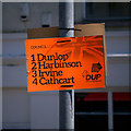
'DUP' election poster, Bangor
Democratic Unionist Party http://www.mydup.com/ poster for the four candidates it put forward for the local council election in the Bangor Central District Electoral Area. The DUP carefully try to manage their votes to ensure that all candidates are returned - there were many variations of this poster around the town but with the candidates in differing orders of preference. On this occasion it was ineffectual as only two of their candidates were elected.
Image: © Rossographer
Taken: 19 Apr 2014
0.06 miles
6
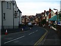
Princetown Avenue, Bangor
A steep little street leading from Somerset Avenue (ahead, unseen) to Princetown Road. Laid out c1905, the block of apartments to the left has only just been constructed.
Image: © Rossographer
Taken: 2 Jun 2008
0.06 miles
7
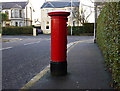
Postbox, Bangor
George V postbox on Farnham Road in Bangor (BT20 407).
Image: © Rossographer
Taken: 17 Jan 2010
0.06 miles
8
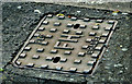
"PLC" fire hydrant cover, Bangor
See Image (April 2011). A similar product, without the “Vina” name, at the Bryansburn Road end of Windsor Avenue. See also Image (December 2011).
Image: © Albert Bridge
Taken: 4 Dec 2012
0.07 miles
9
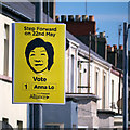
'Alliance' election poster, Bangor
European election poster for Anna Lo of the Alliance Party of Northern Ireland http://allianceparty.org/ . This one was at Dufferin Avenue in Bangor.
Image: © Rossographer
Taken: 19 Apr 2014
0.08 miles
10
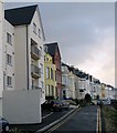
Princetown Avenue, Bangor
Mainly Victorian built avenue overlooking Bangor marina and harbour; the apartments on the left are a very recent addition.
Image: © Rossographer
Taken: 7 Mar 2008
0.08 miles