
IMAGES TAKEN NEAR TO
Rosemary Park, BANGOR, BT20 3ET
Introduction
This page details the photographs taken nearby to Rosemary Park, BT20 3ET by members of the Geograph project.
The Geograph project started in 2005 with the aim of publishing, organising and preserving representative images for every square kilometre of Great Britain, Ireland and the Isle of Man.

There are currently over 7.5m images from over14,400 individuals and you can help contribute to the project by visiting https://www.geograph.org.uk
Image Map
Images are licensed for reuse under creativecommons.org/licenses/by-sa/2.0
Notes
- Clicking on the map will re-center to the selected point.
- The higher the marker number, the further away the image location is from the centre of the postcode.
Image Listing (13 Images Found)
Images are licensed for reuse under creativecommons.org/licenses/by-sa/2.0
Image
Details
Distance
1

Gravestone, Bangor
Gravestone in Bangor New Cemetery to Seaman David Cahill, the first person to be interred in the cemetery. The stone records that he died onboard HMS 'Niobe' https://en.wikipedia.org/wiki/HMS_Niobe_(1897) in Bangor Bay on the 20th July 1899.
Image: © Rossographer
Taken: 8 Nov 2025
0.09 miles
2

Gravestone, Bangor
Gravestone in Bangor New Cemetery to various members of the Mencarelli family. Andrea Mencarelli arrived in Bangor from Italy (via Scotland) c1908, one of several Italian families to settle here.
Image: © Rossographer
Taken: 8 Nov 2025
0.10 miles
3
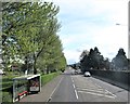
Bus shelter opposite the gate to Bangor Cemetery
The stop is located on the Newtownards Road.
Image: © Eric Jones
Taken: 17 Apr 2017
0.13 miles
4
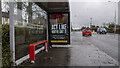
Covid advert, Bangor
Static government Covid awareness advert on a bus shelter at the Newtownards Road, Bangor.
Image: © Rossographer
Taken: 4 Feb 2021
0.15 miles
5
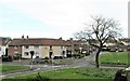
The Loyalist Whitehill Estate. Bangor
This estate is located off the (A21) Newtownards Road.
Image: © Eric Jones
Taken: 17 Apr 2017
0.16 miles
6
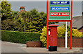
Pillar box, Bangor
EIIR pillar box (BT20 747), at the petrol station/post office, on the corner of the Newtownards Road and Abbey Hill Drive (background).
Image: © Albert Bridge
Taken: 30 May 2012
0.16 miles
7

Postbox topper, Bangor
A Remembrance themed display atop this pillar box in Bangor Image
Image: © Rossographer
Taken: 8 Nov 2025
0.16 miles
8
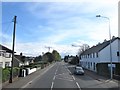
View South along the Newtownards Road at Bangot
Here the Newtownards Road runs through the inner suburbs of Bangor.
Image: © Eric Jones
Taken: 17 Apr 2017
0.18 miles
9
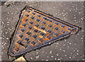
"Hartlid" manhole cover, Bangor
See Image Another triangular cover from the Hartley Sons & Co foundry, Stoke-on-Trent. Similar but not identical. The previous one carried the name “Mute”. This one is a “Hartlid”. Further information about the foundry’s history welcomed. On the Clandeboye Road just inward of Inglewood Park.
Image: © Albert Bridge
Taken: 4 Feb 2011
0.21 miles
10
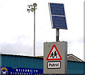
Solar panel, Bangor (2)
Solar panel powering the flashing lights on a “school” sign, outside Clandeboye Park football ground, on the Clandeboye Road.
Image: © Albert Bridge
Taken: 4 Feb 2011
0.21 miles