IMAGES TAKEN NEAR TO
Coastguard Lane, BANGOR, BT19 6LR

Introduction

This page details the photographs taken nearby to Coastguard Lane, BT19 6LR by members of the Geograph project.

The Geograph project started in 2005 with the aim of publishing, organising and preserving representative images for every square kilometre of Great Britain, Ireland and the Isle of Man.

There are currently over 7.5m images from over14,400 individuals and you can help contribute to the project by visiting https://www.geograph.org.uk

Image Map


Images are licensed for reuse under creativecommons.org/licenses/by-sa/2.0
Notes
  • Clicking on the map will re-center to the selected point.
  • The higher the marker number, the further away the image location is from the centre of the postcode.

Image Listing (33 Images Found)

Images are licensed for reuse under creativecommons.org/licenses/by-sa/2.0
  • ...
Image
Details
Distance
1
Sea Thrift, Orlock
Sea Pink or Thrift (Armeria maritima) growing on rocks at Orlock.
Image: © Rossographer Taken: 3 May 2020
0.09 miles
2
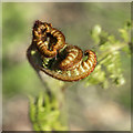
Fern frond, Orlock
Curled fern frond at Orlock.
Image: © Rossographer Taken: 3 May 2020
0.13 miles
3
Hawthorn Fly, Orlock
Hawthorn Fly (Bibio marci or St. Mark's fly) on the old searchlight post Image at Orlock. One of thousands in the area on a warm afternoon.
Image: © Rossographer Taken: 3 May 2020
0.13 miles
4
Old searchlight post, Orlock Point
World War Two era searchlight post at Orlock Point. There were several others, but this is the only one remaining. See also Image The following information regarding Orlock's defensive role during the first half of the 20th Century is taken from 'The Bell' - see http://www.northdown.gov.uk/heritage/bell.pdf World War 2 and Orlock Point: Orlock Point was first identified as an important situation for military defence of Belfast Lough in 1912 when it was established as a Port War Signal Station. At the outbreak of W.W.2 an electrically controlled cable was laid across the Lough between Black Head and Orlock Point with the purpose of detecting submarines as they passed over it. Orlock was also the command post for the Royal Navy Extended Defence Officer whose duty was to control an electrically operated minefield also laid across the entrance to the lough. A cable can still be seen stretching out from Sandeel Bay. On the rocks can be seen the remains of two brick artillery search light enclosures which once had armoured glass shutters. Two 6 inch (152 mm.) BL guns were mounted at Orlock, both protected by concrete gun houses. One of these gun houses has been adapted as a private residence with the naval PVII mounting surviving as a feature on the patio. The other gun house has been removed or engorged by a large new dwelling although the ammunition house remains as a garage. The generator house which provided power for the whole station was hidden behind a rock face below the gun houses. It was demolished a little while ago as it had become an attraction for riff-raff. Orlock Point and the four other defence batteries around Belfast Lough were the only coast defences in the army where women were employed in operational roles. This arrangement had been agreed between the OC Fixed Command in Northern Ireland and the senior ATS officer in Northern Ireland. As it happened they were man and wife. The purpose of the arrangement was to release men for other duties elsewhere but it also relieved the boredom experienced by men on these stations by providing opportunities for mixed ‘recreational’ activities as related in an anecdote by Sir Charles Brett in his book ‘Buildings of North County Down’.
Image: © Rossographer Taken: 5 Mar 2016
0.13 miles
5
Old searchlight post, Orlock Point
World War Two era searchlight post at Orlock Point (see Image for more information). The whins are in full bloom - a wonderful sight and scent.
Image: © Rossographer Taken: 14 May 2016
0.13 miles
6
Old searchlight post, Orlock Point
The old searchlight post at Orlock Point http://www.geograph.org.uk/search.php?i=126190484 on a mild Boxing Day.
Image: © Rossographer Taken: 26 Dec 2020
0.13 miles
7
Spring Squill, Orlock
Spring Squill (Scilla verna) growing on rocks at Orlock.
Image: © Rossographer Taken: 3 May 2020
0.13 miles
8
Gloomy Orlock
June 2019 has seen very mixed weather - dull, cool and with plenty of rain. This is the shoreline at Orlock Point just before the heavens opened again. Compare with Image from a bright January day.
Image: © Rossographer Taken: 16 Jun 2019
0.13 miles
9
The coastline at Orlock
The coastline at Orlock in north County Down. The observation post on the rocks dates from at least World War II and is described in Image; the ships offshore can be seen in detail at Image
Image: © Rossographer Taken: 7 Jan 2012
0.14 miles
10
Towards Orlock
Looking across fields near the shore towards Orlock.
Image: © Rossographer Taken: 4 Nov 2007
0.14 miles
  • ...