IMAGES TAKEN NEAR TO
Harbour Road, BANGOR, BT19 6JP

Introduction

This page details the photographs taken nearby to Harbour Road, BT19 6JP by members of the Geograph project.

The Geograph project started in 2005 with the aim of publishing, organising and preserving representative images for every square kilometre of Great Britain, Ireland and the Isle of Man.

There are currently over 7.5m images from over14,400 individuals and you can help contribute to the project by visiting https://www.geograph.org.uk

Image Map


Images are licensed for reuse under creativecommons.org/licenses/by-sa/2.0
Notes
  • Clicking on the map will re-center to the selected point.
  • The higher the marker number, the further away the image location is from the centre of the postcode.

Image Listing (135 Images Found)

Images are licensed for reuse under creativecommons.org/licenses/by-sa/2.0
  • ...
Image
Details
Distance
1
Harbour Road, Groomsport
Harbour Road in the village of Groomsport. The new build on the left replaces what was once a fish and chip shop Image Taken during the Covid-19 pandemic the local village shop seen at the top of picture - the Spar - was still open and appeared busy but everything else was closed and the village very quiet.
Image: © Rossographer Taken: 24 Mar 2020
0.01 miles
2
The Main Street in Groomsport
At the junction with Harbour Road
Image: © HENRY CLARK Taken: 12 Jun 2009
0.02 miles
3
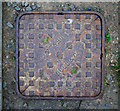
Manhole cover, Groomsport
Manhole cover located close to Groomsport harbour. It is marked "Bell and Co., Belfast" - see similar at Image and Image Further information on the company is welcomed. See Image for a closer view of the inscription.
Image: © Rossographer Taken: 4 Jun 2011
0.02 miles
4
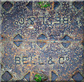
Manhole cover, Groomsport
Detail of the Bell & Co. cover seen in Image located close to Groomsport harbour. Most similar covers spotted appear to have worn very badly, particularly the inscription. This example has retained most of the detail, probably because it is located on a grass verge rather than the roadway.
Image: © Rossographer Taken: 4 Jun 2011
0.02 miles
5
The Main Street in Groomsport
Image: © HENRY CLARK Taken: 12 Jun 2009
0.02 miles
6
Paddling pool, Groomsport
The kiddies’ paddling pool (currently empty) at Groomsport.
Image: © Albert Bridge Taken: 21 Apr 2010
0.02 miles
7
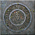
Manhole cover, Groomsport
Detail of a "Davidson and Co." manhole cover in Groomsport. Identical to Image; see also Image, Image and Image
Image: © Rossographer Taken: 4 Jun 2011
0.02 miles
8
Takeaway, Groomsport
'Fish & Chip' takeaway in Groompsort. Single storey flat roofed building near the harbour, it has been a takeaway for as long as I can remember. (Later demolished - see Image]).
Image: © Rossographer Taken: 27 Jun 2009
0.02 miles
9
Pillar box, Groomsport
EIIR pillar box in Main Street, close to the former post office (closed in the last round of closures). Some postal facilities are still available in the nearby “Spar”.
Image: © Albert Bridge Taken: 8 Feb 2011
0.03 miles
10
Sculpture, Groomsport
A piece from 1972, entitled “Aspect One”, between Main Street and the Harbour Road. The sculptor was Thomas Ronald Irvine.
Image: © Albert Bridge Taken: 19 Mar 2009
0.03 miles
  • ...