IMAGES TAKEN NEAR TO
Church Green, BELFAST, BT16 2LP

Introduction

This page details the photographs taken nearby to Church Green, BT16 2LP by members of the Geograph project.

The Geograph project started in 2005 with the aim of publishing, organising and preserving representative images for every square kilometre of Great Britain, Ireland and the Isle of Man.

There are currently over 7.5m images from over14,400 individuals and you can help contribute to the project by visiting https://www.geograph.org.uk

Image Map


Images are licensed for reuse under creativecommons.org/licenses/by-sa/2.0
Notes
  • Clicking on the map will re-center to the selected point.
  • The higher the marker number, the further away the image location is from the centre of the postcode.

Image Listing (175 Images Found)

Images are licensed for reuse under creativecommons.org/licenses/by-sa/2.0
  • ...
Image
Details
Distance
1
"No parking on footway" sign, Dundonald
An unusual sign, at Church Green, and the first of its type that I’ve seen. The footway, here, is similar to a long zebra crossing but parallel to the road and without a kerb - see Image The building on the left in Image is in the background.
Image: © Albert Bridge Taken: 21 May 2014
0.01 miles
2
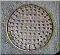
Manhole cover, Dundonald
A 'grip-fix' manhole cover from J. Needham and Sons Limited of Stockport. Similar to Image, this one is located at Church Green, Dundonald.
Image: © Rossographer Taken: 25 Jul 2011
0.02 miles
3
Footway, Dundonald (November 2014)
The unusual footway on the eastern side of Church Green. Parking/obstruction is regulated by this sign Image There is a standard footpath on the other side.
Image: © Albert Bridge Taken: 28 Nov 2014
0.02 miles
4
St Elizabeth's (Church of Ireland), Dundonald (2)
See Image (November 2011). The northern side of the church seen from Church Green. Continue to Image
Image: © Albert Bridge Taken: 29 Oct 2012
0.02 miles
5
Rhododendron flower, Dundonald (May 2014)
See Image 2014 seems to be a good year for rhododendrons – this one is at Moat Park, close to Church Green.
Image: © Albert Bridge Taken: 21 May 2014
0.03 miles
6
New church hall, St Elizabeth's, Dundonald - June 2014(2)
The architect’s impression of how the hall will appear, when complete.
Image: © Albert Bridge Taken: 28 Jun 2014
0.03 miles
7
St Elizabeth's (Church of Ireland), Dundonald
The present St Elizabeth’s church, seen from Moat Park. It replaced the previous church Image Part of the Cleland mausoleum Image is in the background – lower left. Image shows the northern side of the church (October 2012).
Image: © Albert Bridge Taken: 25 Nov 2011
0.03 miles
8
Grave marker, Dundonald
Cast iron grave marker on the grave of one John Kennedy of Dundonald who died in 1897. This is located at the churchyard of St Elizabeth's Church of Ireland in Dundonald Image
Image: © Rossographer Taken: 25 Jul 2011
0.04 miles
9
Dundonald Presbyterian church (2)
See Image The datestone on the southern (Church Green) side.
Image: © Albert Bridge Taken: 29 Oct 2012
0.05 miles
10
New church hall, St Elizabeth's, Dundonald - June 2014(1)
The new hall rising before St Elizabeth’s church (background).
Image: © Albert Bridge Taken: 28 Jun 2014
0.05 miles
  • ...