St Elizabeth's (Church of Ireland), Dundonald
Introduction
The photograph on this page of St Elizabeth's (Church of Ireland), Dundonald by Albert Bridge as part of the Geograph project.
The Geograph project started in 2005 with the aim of publishing, organising and preserving representative images for every square kilometre of Great Britain, Ireland and the Isle of Man.

There are currently over 7.5m images from over 14,400 individuals and you can help contribute to the project by visiting https://www.geograph.org.uk
St Elizabeth's (Church of Ireland), Dundonald
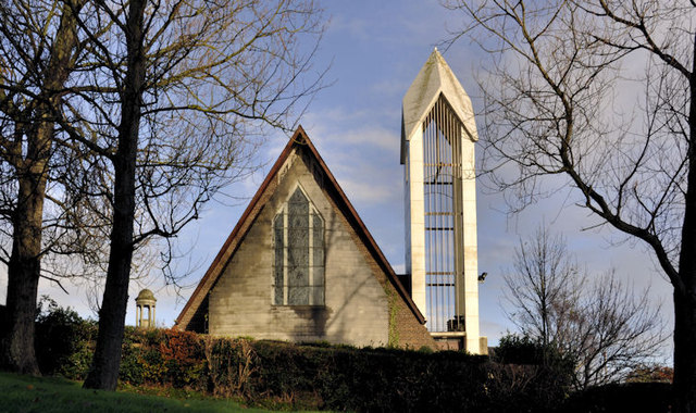
Image: © Albert Bridge Taken: 25 Nov 2011
The present St Elizabeth’s church, seen from Moat Park. It replaced the previous church Image Part of the Cleland mausoleum Image is in the background – lower left. Image shows the northern side of the church (October 2012).
Images are licensed for reuse under creativecommons.org/licenses/by-sa/2.0
Image Location
Latitude
54.592884
Longitude
-5.805739