IMAGES TAKEN NEAR TO
Victoria Parade, BELFAST, BT15 2EQ

Introduction

This page details the photographs taken nearby to Victoria Parade, BT15 2EQ by members of the Geograph project.

The Geograph project started in 2005 with the aim of publishing, organising and preserving representative images for every square kilometre of Great Britain, Ireland and the Isle of Man.

There are currently over 7.5m images from over14,400 individuals and you can help contribute to the project by visiting https://www.geograph.org.uk

Image Map


Images are licensed for reuse under creativecommons.org/licenses/by-sa/2.0
Notes
  • Clicking on the map will re-center to the selected point.
  • The higher the marker number, the further away the image location is from the centre of the postcode.

Image Listing (406 Images Found)

Images are licensed for reuse under creativecommons.org/licenses/by-sa/2.0
  • ...
Image
Details
Distance
1
Artillery Flats, Belfast (June 2014)
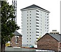
One of the blocks enclosed by scaffolding and mesh. Image shows the new roof. Image shows the block after completion of the work.
Image: © Albert Bridge Taken: 26 Jun 2014
0.01 miles
2
Artillery Flats, Belfast (July 2014)
See Image The block now has a pitched roof to replace the original flat one. Continue to Image
Image: © Albert Bridge Taken: 27 Jul 2014
0.01 miles
3
Artillery Flats, Belfast (June 2015)
See Image Work continuing on the renovation of this block overlooking North Queen Street. The change is much more extensive than I’d realised but it must be remembered that the flats were built circa 50 years ago.
Image: © Albert Bridge Taken: 15 Jun 2015
0.01 miles
4
Artillery Flats (refurbished), Belfast (October 2015)
A completely renovated block seen from North Queen Street. Image shows the building at an early stage of the work. Image shows a second renovated block.
Image: © Albert Bridge Taken: 23 Oct 2015
0.01 miles
5
The Artillery Flats, Belfast
These flats date from the 1960s.
Image: © Eric Jones Taken: 9 Aug 2011
0.01 miles
6
The Westlink at New Lodge
The Westlink links the M1 and M2 motorways. The flats are in New Lodge - a strongly Nationalist area of Belfast. The tall blocks are the Artillery Flats, built on the site of a former Artillery Base - there are 7 in all.
Image: © Eric Jones Taken: 13 Aug 2011
0.03 miles
7
The Artillery Flats
Image: © Eric Jones Taken: 9 Aug 2011
0.04 miles
8
Murals, North Queen Street, Belfast (June 2016)
Fading murals, depicting local scenes from the past, beside the Westlink flyover Image
Image: © Albert Bridge Taken: 15 Jun 2016
0.05 miles
9
Westlink flyover, Belfast
The Westlink Image crosses North Queen Street by this flyover. The M2 is to the right. The wall of the former police station Image is on the left.
Image: © Albert Bridge Taken: 2 Apr 2014
0.05 miles
10
Apartments in Carlisle Road, Belfast
These stand adjacent to the Artillery Flats. The image is taken from the Westlink a dual carriageway throughpass, designated the A12, and connecting the M1 to the M2 and M3 motorways
Image: © Eric Jones Taken: 9 Aug 2011
0.06 miles
  • ...