IMAGES TAKEN NEAR TO
Britannic Terrace, BELFAST, BT12 5HS
Introduction
This page details the photographs taken nearby to Britannic Terrace, BT12 5HS by members of the Geograph project.
The Geograph project started in 2005 with the aim of publishing, organising and preserving representative images for every square kilometre of Great Britain, Ireland and the Isle of Man.

There are currently over 7.5m images from over14,400 individuals and you can help contribute to the project by visiting https://www.geograph.org.uk
Image Map
Images are licensed for reuse under creativecommons.org/licenses/by-sa/2.0
Notes
- Clicking on the map will re-center to the selected point.
- The higher the marker number, the further away the image location is from the centre of the postcode.
Image Listing (801 Images Found)
Images are licensed for reuse under creativecommons.org/licenses/by-sa/2.0
Image
Details
Distance
1
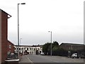
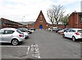
View along Linfield Gardens towards the Weaver's Court Business Estate
This purpose built business park offers offices and warehouseing and storage facilities in the heart of Belfast City Centre
Image: © Eric Jones
Taken: 17 Feb 2015
0.04 miles
2
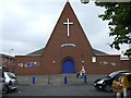
Sandy Row Methodist Church
It is located along Sandy Row.
Image: © Kenneth Allen
Taken: 26 Jul 2008
0.05 miles
3
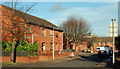
Clementine Drive, Belfast
Clementine Drive follows the approximate line of the old Clementine Street (built in the late 1870’s and originally off Tea Lane). Now part of the re-built area off Sandy Row.
Image: © Albert Bridge
Taken: 26 Nov 2009
0.06 miles
5
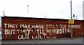
Message on the Wall of the Belfast Ice Dome
This graffiti is in Linfield Gardens on the edge of the staunchly Loyalist Sandy Row area. It refers to the decision of the Belfast City Council to restrict the flying of the Union Flag over Belfast City Hall to a number of designated days each year.
Image: © Eric Jones
Taken: 17 Feb 2015
0.08 miles
6
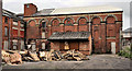
Former Ulster Brewery, Belfast
The remains of the former Ulster Brewery just off Sandy Row. Built in 1869 to a design by Alex McAllister. The archway was listed as HB26/29/002 but was subsequently delisted. Not on the official “at risk” register. For the record the building was used to train the volunteers who later formed part of the 36th Ulster Division at the Somme. See also Image
Image: © Albert Bridge
Taken: 19 Jun 2011
0.09 miles
7
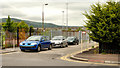
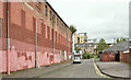
Watson Street, Belfast
Watson Street (“Vulcan Street” on the Google map) dates from about 1877/79. It ran from the Linfield Road to Railway Street and had “a number of small houses”. Now gone and just a line.
Image: © Albert Bridge
Taken: 18 Jun 2010
0.09 miles
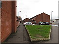
8
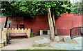
Sandy Row community garden, Belfast (1)
One of a number of small open spaces, off Sandy Row, opened in 2009. Continue to Image
Image: © Albert Bridge
Taken: 18 Jun 2010
0.09 miles
9
McAdam Park Methodist Church in Sandy Row
Image: © Eric Jones
Taken: 19 May 2012
0.09 miles
10
The Gilpin's site, Sandy Row, Belfast - August 2019(2)
The site (left), looking, from Boyne Court, to Sandy Row (background).
Image: © Albert Bridge
Taken: 11 Aug 2019
0.09 miles