IMAGES TAKEN NEAR TO
Dentwood Grove, BRISTOL, BS9 2QH
Introduction
This page details the photographs taken nearby to Dentwood Grove, BS9 2QH by members of the Geograph project.
The Geograph project started in 2005 with the aim of publishing, organising and preserving representative images for every square kilometre of Great Britain, Ireland and the Isle of Man.

There are currently over 7.5m images from over14,400 individuals and you can help contribute to the project by visiting https://www.geograph.org.uk
Image Map
Images are licensed for reuse under creativecommons.org/licenses/by-sa/2.0
Notes
- Clicking on the map will re-center to the selected point.
- The higher the marker number, the further away the image location is from the centre of the postcode.
Image Listing (18 Images Found)
Images are licensed for reuse under creativecommons.org/licenses/by-sa/2.0
Image
Details
Distance
2
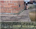
Ordnance Survey Cut Mark
This OS cut mark can be found on No47 Westbury Lane. It marks a point 38.100m above mean sea level.
Image: © Adrian Dust
Taken: 1 Nov 2021
0.13 miles
3
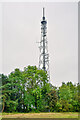
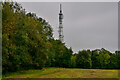
Henbury : Mast
A television mast on top of Kings Weston Hill.
Image: © Lewis Clarke
Taken: 8 Sep 2020
0.18 miles
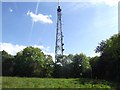
5
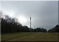
Henbury : Grassy Field
A television mast on top of Kings Weston Hill.
Image: © Lewis Clarke
Taken: 8 Sep 2020
0.19 miles
7
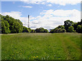
Kings Weston Hill and Transmitter
Looking along the path, which runs along the ridge of Kings Weston Hill, towards the transmitter. The ridge is grassland, with the sides of the ridge covered by woodland on both sides.
Image: © Linda Bailey
Taken: 29 May 2006
0.19 miles
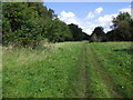
8
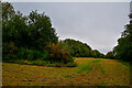
Henbury : Grassy Field
A right of way heads through the field.
Image: © Lewis Clarke
Taken: 8 Sep 2020
0.20 miles
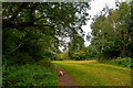
9
Path on King Weston Hill
Heading towards Blaise Castle
Image: © Eirian Evans
Taken: 19 Sep 2017
0.20 miles
10
Henbury : Grassy Field
A grassy field and right of way heading through.
Image: © Lewis Clarke
Taken: 8 Sep 2020
0.20 miles