1
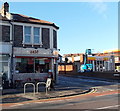
Bristol : Quarrington Road
A small road leading to Downend Road.
Image: © Lewis Clarke
Taken: 24 Mar 2015
0.03 miles
2
Bristol Fryer, Horfield
Image: © Roger Cornfoot
Taken: 7 Oct 2020
0.06 miles
3
Gloucester Road, Horfield
Looking north along the A38 from the junction with Ashley Down Road. On the right is a soft play coffee lounge, followed by a hairdressers, a letting agency and an Indian curry house.
Image: © Derek Harper
Taken: 16 Nov 2015
0.06 miles
4
Zest in Horfield, Bristol
Zest is a Mediterranean cuisine cafe bar lounge at 408 Gloucester Road, on the corner of Church Road.
Image: © Jaggery
Taken: 29 Dec 2013
0.07 miles
5
Floyds Barber Shop and Street Art Gallery, Horfield, Bristol
Floyds website states that "Our barbershop (at 390 Gloucester Road) provides a unique mix where you can check out Bristol’s latest street art, listen to some of Bristol's finest music and of course get quite possibly the sharpest haircut in the city!".
Also in view are Café Rhubarb on the left and Laroussi gallery on the right.
Image: © Jaggery
Taken: 29 Dec 2013
0.07 miles
6
The Queen Vic, Bristol
The Gloucester Road pub was formerly named the Victoria Inn.
The yellow No Entry sign is at the exit from a Shell filling station. http://www.geograph.org.uk/photo/4015421
Image: © Jaggery
Taken: 29 Dec 2013
0.08 miles
7
Bristol : Gloucester Road
A main road heading through Bristol.
Image: © Lewis Clarke
Taken: 24 Mar 2015
0.08 miles
8
Bristol : Gloucester Road
The pavement alongside some shops and a bus stop on Gloucester Road.
Image: © Lewis Clarke
Taken: 24 Mar 2015
0.08 miles
9
Gloucester Road Shell filling station, Bristol
The filling station, car wash and shop is on the corner of Gloucester Road and Church Road.
Image: © Jaggery
Taken: 29 Dec 2013
0.08 miles
10
Ashley Down Junior School
Image: © Linda Bailey
Taken: 11 Feb 2006
0.08 miles


