IMAGES TAKEN NEAR TO
Wordsworth Road, BRISTOL, BS7 0EL
Introduction
This page details the photographs taken nearby to Wordsworth Road, BS7 0EL by members of the Geograph project.
The Geograph project started in 2005 with the aim of publishing, organising and preserving representative images for every square kilometre of Great Britain, Ireland and the Isle of Man.

There are currently over 7.5m images from over14,400 individuals and you can help contribute to the project by visiting https://www.geograph.org.uk
Image Map
Images are licensed for reuse under creativecommons.org/licenses/by-sa/2.0
Notes
- Clicking on the map will re-center to the selected point.
- The higher the marker number, the further away the image location is from the centre of the postcode.
Image Listing (69 Images Found)
Images are licensed for reuse under creativecommons.org/licenses/by-sa/2.0
Image
Details
Distance
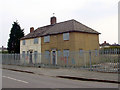
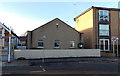
1
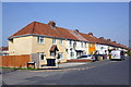
Houses on Eighth Avenue
Interesting variety of wall treatments and colours. The render on the nearest house (#2) at the junction with Browning Court has obliterated an Ordnance Survey benchmark
Image: © Roger Templeman
Taken: 24 Mar 2012
0.03 miles
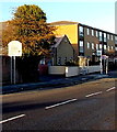
2
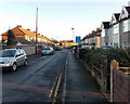
Sixth Avenue, Filton
Viewed from the Filton Avenue end.
Image: © Jaggery
Taken: 29 Dec 2013
0.03 miles
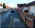
3
Eden Grove, Bristol
Viewed from Filton Avenue looking ESE towards Emerson Square.
Image: © Jaggery
Taken: 29 Dec 2013
0.06 miles
4
Demolished Houses
This photo is taken from the same spot as Image] and shows that the house has been demolished (although the tree remains).
Image: © Linda Bailey
Taken: 6 Sep 2006
0.07 miles
5
Houses to be demolished, Filton
These houses on Eden Grove, in Filton are to be demolished and replaced with a new housing development. The council houses which appear on the 1940's map, and were probably built at that time, suffered from "concrete cancer". Immediately on the other side of Filton Avenue are the recently completed houses Image
Update: Houses now gone on 31st March 2006.
Image: © Linda Bailey
Taken: 23 Mar 2006
0.07 miles
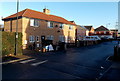
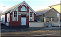
6
Seventh Avenue, Filton
Viewed from the corner of Filton Avenue.
Image: © Jaggery
Taken: 29 Dec 2013
0.08 miles
7
Booth Court, Filton
Booth Court at 468 Filton Avenue contains 6 flats. Pyramid Youth Club http://www.geograph.org.uk/photo/4015852 is on the right.
Image: © Jaggery
Taken: 29 Dec 2013
0.10 miles
8
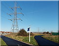
Pylon near a path junction, Concorde Way, Horfield, Bristol
Located near playing fields between Horfield and Lockleaze.
Image: © Jaggery
Taken: 29 Dec 2013
0.10 miles
9
Pyramid Youth Club, Filton
Located at 470 Filton Avenue, a few metres on the South Gloucestershire side of the Bristol boundary.
Image: © Jaggery
Taken: 29 Dec 2013
0.10 miles
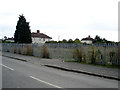
10
Southern boundary of Filton
Viewed across Filton Avenue in Bristol looking into Filton,
a town in South Gloucestershire, c7km from Bristol city centre.
Image: © Jaggery
Taken: 29 Dec 2013
0.10 miles