IMAGES TAKEN NEAR TO
Andruss Drive, BRISTOL, BS41 8LJ
Introduction
This page details the photographs taken nearby to Andruss Drive, BS41 8LJ by members of the Geograph project.
The Geograph project started in 2005 with the aim of publishing, organising and preserving representative images for every square kilometre of Great Britain, Ireland and the Isle of Man.

There are currently over 7.5m images from over14,400 individuals and you can help contribute to the project by visiting https://www.geograph.org.uk
Image Map
Images are licensed for reuse under creativecommons.org/licenses/by-sa/2.0
Notes
- Clicking on the map will re-center to the selected point.
- The higher the marker number, the further away the image location is from the centre of the postcode.
Image Listing (114 Images Found)
Images are licensed for reuse under creativecommons.org/licenses/by-sa/2.0
Image
Details
Distance
1
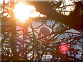
A sheep field in the snow
A small flock of sheep scratch around for some morsels as the sun slips towards the horizon.
Image: © Neil Owen
Taken: 28 Dec 2017
0.06 miles
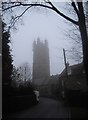
2
Church Road
As seen for Dundry's St Michael's church tower.
Image: © Neil Owen
Taken: 14 Jun 2014
0.10 miles
3
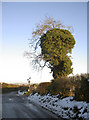
Creepy creeper
A tree at the end of Crabtree Lane is, like many around here, smothered with creeping vegetation. The overall effect gives the tree a strange and eerie appearance.
Image: © Neil Owen
Taken: 28 Dec 2017
0.10 miles
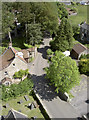
4
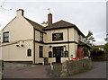
2009 : The Dundry Inn, Dundry
"The Dundry Inn is directly opposite St. Michael's Church at the heart of the pretty village of Dundry which is situated at the top of Dundry Hill close to the A38 some 5 miles south west of Bristol. There are some magnificent views across Bristol from the low stone-walled garden of The Dundry Inn."
The above was copied from: http://www.dundryinn.co.uk/
Image: © Maurice Pullin
Taken: 26 May 2009
0.10 miles
7
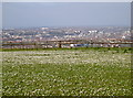
Dundry daisies
Looking out over the Dundry slopes to the expanse of Bristol, this horse paddock is covered with daisies.
Image: © Neil Owen
Taken: 9 Apr 2014
0.11 miles
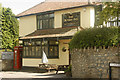
8
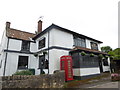
The Dundry Inn
Recently under new management since early 2011, the pub features that most modern of facilities - the smokers' hut (right of shot).
Image: © Neil Owen
Taken: 18 Nov 2011
0.11 miles
9

Dundry Tavern in the swirl
It's rare the air stops blowing over the top of Dundry, but when it does that can cause an eerie mist to develop.
Image: © Neil Owen
Taken: 19 Dec 2021
0.11 miles
10
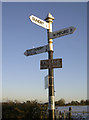
An old sign to a new hall
The signpost at the junction of Crabtree Lane, Church Road and West Dundry Lane includes a rather old-looking pointer to the village hall. Could it be a pre-Worboys sign? It's worth noting the hall is a relatively new one of 1988.
Image: © Neil Owen
Taken: 28 Dec 2017
0.11 miles