IMAGES TAKEN NEAR TO
Blind Lane, BRISTOL, BS40 8UA
Introduction
This page details the photographs taken nearby to Blind Lane, BS40 8UA by members of the Geograph project.
The Geograph project started in 2005 with the aim of publishing, organising and preserving representative images for every square kilometre of Great Britain, Ireland and the Isle of Man.

There are currently over 7.5m images from over14,400 individuals and you can help contribute to the project by visiting https://www.geograph.org.uk
Image Map (Loading...)


Getting Data...Please wait
Leaflet Map data © OpenStreetMap
Images are licensed for reuse under creativecommons.org/licenses/by-sa/2.0
Notes
- Clicking on the map will re-center to the selected point.
- The higher the marker number, the further away the image location is from the centre of the postcode.
Image Listing (170 Images Found)
Images are licensed for reuse under creativecommons.org/licenses/by-sa/2.0
Image
Details
Distance
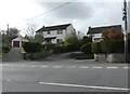
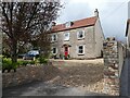
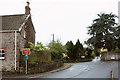
2
Blind Lane
The houses along it are all modern and give no clue as to why it is called so.
Image: © Neil Owen
Taken: 5 Sep 2014
0.03 miles
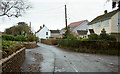
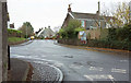
3
Pilgrims Way, Chew Stoke
A reverse view of Image]; Blind Lane is to the left. The Two Rivers Way follows Pilgrims Way.
Image: © Derek Harper
Taken: 25 Nov 2019
0.04 miles
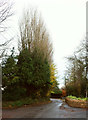
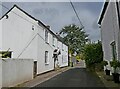
4
Pilgrims Way, Chew Stoke
Carrying the Two Rivers Way as it passes the junction with Blind Lane (right).
Image: © Derek Harper
Taken: 25 Nov 2019
0.04 miles
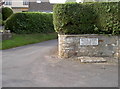
5
Pilgrims Way, Chew Stoke
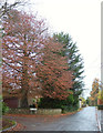
Passing The Cedars, a small cul-de-sac guarded by a large copper beech.
Image: © Derek Harper
Taken: 25 Nov 2019
0.05 miles
8
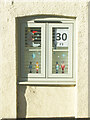
A Christmas window scene
Chew Stoke is holding a Christmas festive window trail, organised by Chew Stoke Church School PTA.
Image: © Neil Owen
Taken: 1 Dec 2020
0.07 miles
9
Crossroads, Chew Stoke
A reverse view of Image] from the B3114 from Chew Magna, turning left here into the centre of the village. The Two Rivers Way goes straight on along Pilgrims Way.
Image: © Derek Harper
Taken: 25 Nov 2019
0.07 miles
10
Junction, Chew Stoke
A crossroads at the north end of the village. To left and straight ahead is the B3114. The village centre is to the right; behind the camera is Pilgrims Way, towards the church.
Image: © Derek Harper
Taken: 25 Nov 2019
0.08 miles