1
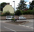
Flower tub on a triangle, Iron Acton
In the middle of the junction of Nibley Lane and Holly Hill.
Image: © Jaggery
Taken: 12 Jul 2017
0.02 miles
2
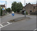
Nibley Lane houses, Iron Acton
Viewed from Holly Hill.
Image: © Jaggery
Taken: 12 Jul 2017
0.03 miles
3
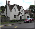
Grade II listed The Nook, Wotton Road, Iron Acton
The datestone http://www.geograph.org.uk/photo/5459750 on the wall above the front door shows the year 1688.
The Nook was Grade II listed in 1952.
Image: © Jaggery
Taken: 12 Jul 2017
0.03 miles
4
Datestone 1688, The Nook, Wotton Road, Iron Acton
The datestone on this house http://www.geograph.org.uk/photo/5459744 shows M/IE/1688.
Image: © Jaggery
Taken: 12 Jul 2017
0.03 miles
5
School Buildings
Image: © don cload
Taken: 7 May 2017
0.03 miles
6
Iron Acton Primary School, Iron Acton
Set back from the east side of Wotton Road.
Image: © Jaggery
Taken: 12 Jul 2017
0.03 miles
7
Junction of Holly Hill and Wotton Road, Iron Acton
High Street Iron Acton is ahead on the left.
Image: © Jaggery
Taken: 12 Jul 2017
0.04 miles
8
The Lamb Inn, Iron Acton
Image: © David Howard
Taken: 14 Mar 2020
0.04 miles
9
King George V postbox in a Wotton Road wall, Iron Acton
Located here. http://www.geograph.org.uk/photo/5459839 The GR on the box is short for Georgius Rex,
Latin for King George, in this case King George V
who reigned from May 1910-January 1936.
Image: © Jaggery
Taken: 12 Jul 2017
0.04 miles
10
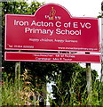
Iron Acton C of E VC Primary School name sign, Iron Acton
Located here. http://www.geograph.org.uk/photo/5459839 C of E = Church of England. VC = Voluntary Controlled.
A VC school must provide for all pupils to take part in a daily act of collective worship,
which must reflect the broad traditions of Christian belief and be wholly Christian in character.
Image: © Jaggery
Taken: 12 Jul 2017
0.04 miles


