IMAGES TAKEN NEAR TO
Westerleigh Road, BRISTOL, BS36 2UP
Introduction
This page details the photographs taken nearby to Westerleigh Road, BS36 2UP by members of the Geograph project.
The Geograph project started in 2005 with the aim of publishing, organising and preserving representative images for every square kilometre of Great Britain, Ireland and the Isle of Man.

There are currently over 7.5m images from over14,400 individuals and you can help contribute to the project by visiting https://www.geograph.org.uk
Image Map (Loading...)


Getting Data...Please wait
Leaflet Map data © OpenStreetMap
Images are licensed for reuse under creativecommons.org/licenses/by-sa/2.0
Notes
- Clicking on the map will re-center to the selected point.
- The higher the marker number, the further away the image location is from the centre of the postcode.
Image Listing (23 Images Found)
Images are licensed for reuse under creativecommons.org/licenses/by-sa/2.0
Image
Details
Distance
1
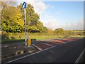
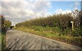
Westerleigh Road at Henfield
With a pedestrian refuge, useful on this busy if unclassified road, at the location where Image] was taken.
Image: © Derek Harper
Taken: 22 Nov 2013
0.03 miles
2
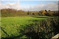
Field beside Henfield Business Park
Between the business park and Westerleigh Road, and crossed by footpath LWE/69.
Image: © Derek Harper
Taken: 22 Nov 2013
0.05 miles
3
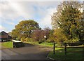
Entrance to Henfield Business Park
This is used by footpath LWE/69.
Image: © Derek Harper
Taken: 22 Nov 2013
0.05 miles
4
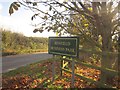
Henfield Business Park
The sign on the entrance from the lane to Lydegreen Bridge.
Image: © Derek Harper
Taken: 22 Nov 2013
0.07 miles
5
Lane past Henfield Business Park
Looking in the other direction up the lane from the entrance shown in Image The footpath is LWE/68.
Image: © Derek Harper
Taken: 22 Nov 2013
0.07 miles
6
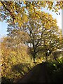
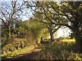
Cooks Lane
Further southeast along the little lane shown in Image], with autumnal oaks.
Image: © Derek Harper
Taken: 22 Nov 2013
0.07 miles
7
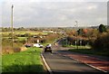
Westerleigh Road at Henfield
The crossroads with Henfield Road. In the distance is Oakley Green Garden Centre.
Image: © Derek Harper
Taken: 22 Nov 2013
0.08 miles
8
Cooks Lane
Looking in the other direction to Image
Image: © Derek Harper
Taken: 22 Nov 2013
0.11 miles
9
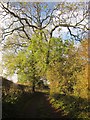
Cooks Lane
A tiny little lane at Henfield, linking The Hollows to the busy Westerleigh Road.
Image: © Derek Harper
Taken: 22 Nov 2013
0.12 miles
10
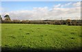
Field, Parkgate Farm
Crossed by footpath LWE/68, and seen from the other side of the hedge in Image] after crossing a stile with no crosspiece, which seems to be the pattern around here; see Image There are some interesting-looking bumps in this field.
Image: © Derek Harper
Taken: 22 Nov 2013
0.13 miles