IMAGES TAKEN NEAR TO
Itchington, Alveston, BRISTOL, BS35 3TG
Introduction
This page details the photographs taken nearby to BS35 3TG by members of the Geograph project.
The Geograph project started in 2005 with the aim of publishing, organising and preserving representative images for every square kilometre of Great Britain, Ireland and the Isle of Man.

There are currently over 7.5m images from over14,400 individuals and you can help contribute to the project by visiting https://www.geograph.org.uk
Image Map
Images are licensed for reuse under creativecommons.org/licenses/by-sa/2.0
Notes
- Clicking on the map will re-center to the selected point.
- The higher the marker number, the further away the image location is from the centre of the postcode.
Image Listing (17 Images Found)
Images are licensed for reuse under creativecommons.org/licenses/by-sa/2.0
Image
Details
Distance
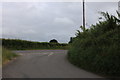
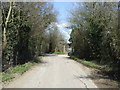
4
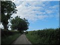
Lane to Itchington
Looking north across South Gloucestershire countryside.
Image: © Jonathan Billinger
Taken: 21 Jan 2011
0.12 miles
5
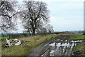
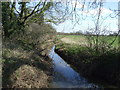
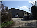
Mud and flytip
A field by the lane at Image has seen some unwelcome attention.
Image: © Jonathan Billinger
Taken: 21 Jan 2011
0.15 miles
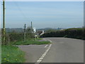
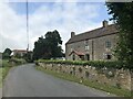
8
Shellards Lane at the junction of Earthcott Road
Image: © David Howard
Taken: 23 May 2020
0.20 miles
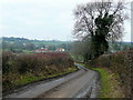
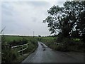
10
Itchington Road heading north
Towards Tytherington.
Image: © JThomas
Taken: 2 Apr 2013
0.21 miles