1
The Borough Stone at Gillingstool
This stone marks the historic boundary of Thornbury on its eastern side. The original stone disappeared at the end of the 19th century, and this replacement, of local "Thornbury Rock" (Dolomitic Conglomerate of the Triassic period) was installed in 1996.
Image: © Ruth Riddle
Taken: 27 Apr 2011
0.03 miles
2
Sodium-lit subway, Gillingstool
Image: © Robin Stott
Taken: 20 Sep 2010
0.05 miles
3
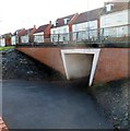
Gillingstool underpass, Thornbury
Located near the corner of Oakleaze Road, this underpass is beneath the main road named Gillingstool.
Image: © Jaggery
Taken: 2 Jan 2012
0.05 miles
4
Gillingstool houses, Thornbury
Viewed across Gillingstool looking towards the corner of St David's Road.
Image: © Jaggery
Taken: 1 Jan 2012
0.06 miles
5
Pelican crossing, Gillingstool, Thornbury
Across the road named Gillingstool. Chambers Dictionary states that pelican
in this context is adapted from "pedestrian light controlled crossing".
Image: © Jaggery
Taken: 2 Aug 2020
0.08 miles
6
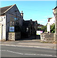
Former school, Gillingstool, Thornbury
Inscriptions on the right show BOYS 1862.
Inscriptions on the left show GIRLS 1862
Image: © Jaggery
Taken: 2 Aug 2020
0.08 miles
7
Petrol filling station, Gillingstool
Seen from the corner of Knapp Road.
Image: © Robin Stott
Taken: 18 Sep 2010
0.09 miles
8
Little Acorns Day Nursery, Thornbury
Located in a former school on the south side of Gillingstool.
The inscription in stone on the building is INFANTS 1898.
Image: © Jaggery
Taken: 1 Jan 2012
0.09 miles
9
Entrance to Little Acorns, Gillingstool, Thornbury
Little Acorns day nursery and preschool is in a former school building on the south side of the road named Gillingstool.
Image: © Jaggery
Taken: 2 Aug 2020
0.09 miles
10
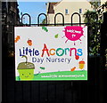
Welcome to Little Acorns Day Nursery, Thornbury
On the right here. https://www.geograph.org.uk/photo/6565812
Image: © Jaggery
Taken: 2 Aug 2020
0.09 miles


