IMAGES TAKEN NEAR TO
Falcon Way, BRISTOL, BS35 1TA
Introduction
This page details the photographs taken nearby to Falcon Way, BS35 1TA by members of the Geograph project.
The Geograph project started in 2005 with the aim of publishing, organising and preserving representative images for every square kilometre of Great Britain, Ireland and the Isle of Man.

There are currently over 7.5m images from over14,400 individuals and you can help contribute to the project by visiting https://www.geograph.org.uk
Image Map (Loading...)


Getting Data...Please wait
Leaflet Map data © OpenStreetMap
Images are licensed for reuse under creativecommons.org/licenses/by-sa/2.0
Notes
- Clicking on the map will re-center to the selected point.
- The higher the marker number, the further away the image location is from the centre of the postcode.
Image Listing (23 Images Found)
Images are licensed for reuse under creativecommons.org/licenses/by-sa/2.0
Image
Details
Distance
1
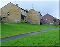
Path past Celandine Close houses, Thornbury
Viewed from Morton Way in the NE of Thornbury.
Image: © Jaggery
Taken: 2 Jan 2012
0.16 miles
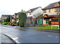
2
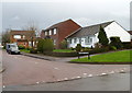
Squires Leaze, Thornbury
Viewed across Severn View Road.
Image: © Jaggery
Taken: 2 Jan 2012
0.16 miles
3
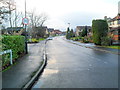
Primrose Drive, Thornbury
Viewed from the Morton Way end. Primrose Drive is the main road through an area of suburban housing in the NE of Thornbury, giving access to several cul-de-sacs.
Image: © Jaggery
Taken: 2 Jan 2012
0.16 miles
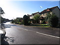
4
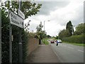
Morton Way, Thornbury
Morton Way is a perimeter road that forms the boundary to Thornbury's residential estates, on the left here. The view is north-ish from the end of Knapp Road. It continues east as Crossways Lane.
Image: © Robin Stott
Taken: 18 Sep 2010
0.16 miles
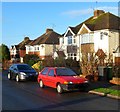
6
Primrose Drive houses, Thornbury
The houses are on the north side of Primrose Drive, between Morton Way and the corner of Sorrel Close. The location is at the eastern edge of Thornbury.
Image: © Jaggery
Taken: 2 Jan 2012
0.18 miles
7
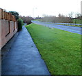
Morton Way footpath, Thornbury
The location is at the NE edge of Thornbury.
Image: © Jaggery
Taken: 2 Jan 2012
0.20 miles
8
Eastbury Road houses, Thornbury
Viewed from near St Mary's Church Hall. http://www.geograph.org.uk/photo/3396674
Image: © Jaggery
Taken: 2 Jan 2012
0.20 miles
9
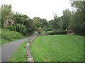
Streamside Walk Linear Park: 1
The view east from above Morton Bridge on the Gloucester Road. Thornbury's 20th-century residential estates are all to the east of the historic town. They have the feel of a New Town – planned expansion. I was reminded (favourably) of Redditch.
Image: © Robin Stott
Taken: 18 Sep 2010
0.21 miles
10
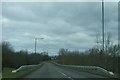
Morton Way crossing a stream
Here Morton Way crosses a small stream with wooded banks which runs through the housing estates of northern Thornbury for about 1km.
Image: © Ruth Riddle
Taken: 15 Feb 2012
0.21 miles