1
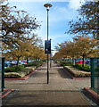
Near Stoke Gifford Junction
Image: © N Chadwick
Taken: 17 Apr 2016
0.02 miles
2
Aviva, Stoke Gifford
The Aviva Centre, Stoke Gifford.
Image: © Alan Hughes
Taken: 11 Aug 2017
0.03 miles
3
Friends Life offices, Stoke Gifford
Viewed from Brierly Furlong. Friends Life has a wide range of products for individual customers, commercial businesses and other institutions. These include life assurance, pensions and investments.
Image: © Jaggery
Taken: 18 Oct 2012
0.05 miles
4
Tree-lined entrance footpath to Friends Life offices, Stoke Gifford
The 250 metre long footpath connects the corner of Fox Den Road and Great Stoke Way with the Friends Life offices. http://www.geograph.org.uk/photo/3188363 The notice warns that this is private property with no public right of way. Cyclists are asked to dismount. CCTV recording is in operation.
Image: © Jaggery
Taken: 18 Oct 2012
0.05 miles
5
Southern boundary of Stoke Gifford
The road named Brierly Furlong reaches Stoke Gifford, South Gloucestershire.
Before the 1980s Stoke Gifford was a small village. During a period of rapid growth, its population was 11,509 on the day of the 2001 Census. It is now effectively a northern suburb of Bristol, and is the location of Bristol Parkway railway station.
Image: © Jaggery
Taken: 18 Oct 2012
0.06 miles
6
Brierly Furlong
Image: © JThomas
Taken: 11 May 2013
0.11 miles
7
Landscaping at the Friends Life Centre
Image: © Eirian Evans
Taken: 28 Jan 2014
0.11 miles
8
Entrance to Friends Life offices, Stoke Gifford
The entrance road is on the east side of the roundabout at the Fox Den Road / Brierly Furlong junction. Friends Life has a wide range of products for individual customers, commercial businesses and other institutions. These include life assurance, pensions and investments.
Image: © Jaggery
Taken: 18 Oct 2012
0.12 miles
9
City of Bristol College, New Road
Image: © Roger Templeman
Taken: 3 May 2014
0.12 miles
10
Construction in New Rd
This is the new Bristol Technology Engineering Acadamey taking shape in Stoke Gifford.
Image: © Nigel Mykura
Taken: 17 Mar 2013
0.12 miles


