IMAGES TAKEN NEAR TO
Shrub Leaze, BS34 8DU
Introduction
This page details the photographs taken nearby to Shrub Leaze, BS34 8DU by members of the Geograph project.
The Geograph project started in 2005 with the aim of publishing, organising and preserving representative images for every square kilometre of Great Britain, Ireland and the Isle of Man.

There are currently over 7.5m images from over14,400 individuals and you can help contribute to the project by visiting https://www.geograph.org.uk
Image Map
Images are licensed for reuse under creativecommons.org/licenses/by-sa/2.0
Notes
- Clicking on the map will re-center to the selected point.
- The higher the marker number, the further away the image location is from the centre of the postcode.
Image Listing (40 Images Found)
Images are licensed for reuse under creativecommons.org/licenses/by-sa/2.0
Image
Details
Distance
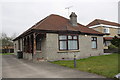
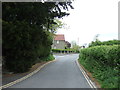
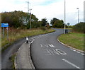
1
View to Harry Stoke
Like Image], a view across Harry Stoke Road at its junction with Filton Road. The houses visible across the field are on a cul-de-sac on the east side of Harry Stoke Road.
Image: © Derek Harper
Taken: 19 Jan 2018
0.04 miles
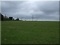
5
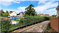
Edge of estate
The new path and housing far right has been in place a few months.
On the other side of the hedge is Harry Stoke Road.
Image: © Jonathan Billinger
Taken: 19 Aug 2023
0.06 miles
6
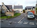
Numbers 40-32 Harry Stoke Road, Harry Stoke
Recently-built houses in Harry Stoke Road are set back from the main route of the roadway, which is from left to right at the bottom of the view.
Image: © Jaggery
Taken: 18 Oct 2012
0.08 miles
7
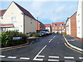
John St Quinton Close, Harry Stoke, Stoke Gifford
Viewed across Harry Stoke Road. The new houses are in a close named after the late John St Quinton who moved to Stoke Gifford in 1958, and was its postmaster from 1970 to 2003.
Image: © Jaggery
Taken: 18 Oct 2012
0.09 miles
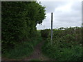
8
One-way bus route, Harry Stoke Road, Harry Stoke
The blue sign shows that the only motor vehicles that can use this road are buses, towards the camera. Cyclists can use this road in either direction.
Image: © Jaggery
Taken: 18 Oct 2012
0.12 miles
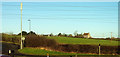
9
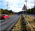
A4174 heads east towards Hambrook and Frenchay
Viewed from opposite the north entrance http://www.geograph.org.uk/photo/3474847 to UWE Bristol Frenchay campus.
Image: © Jaggery
Taken: 18 Oct 2012
0.13 miles