IMAGES TAKEN NEAR TO
Worthing Road, BRISTOL, BS34 5HX

Introduction

This page details the photographs taken nearby to Worthing Road, BS34 5HX by members of the Geograph project.

The Geograph project started in 2005 with the aim of publishing, organising and preserving representative images for every square kilometre of Great Britain, Ireland and the Isle of Man.

There are currently over 7.5m images from over14,400 individuals and you can help contribute to the project by visiting https://www.geograph.org.uk

Image Map


Images are licensed for reuse under creativecommons.org/licenses/by-sa/2.0
Notes
  • Clicking on the map will re-center to the selected point.
  • The higher the marker number, the further away the image location is from the centre of the postcode.

Image Listing (16 Images Found)

Images are licensed for reuse under creativecommons.org/licenses/by-sa/2.0
Image
Details
Distance
1
Patchway Community Centre
Image: © Roger Cornfoot Taken: 3 Apr 2023
0.07 miles
2
Patchway Town Council Offices
Image: © Roger Cornfoot Taken: 3 Apr 2023
0.08 miles
3
Patchway Community Centre
Large building on the corner of Rodway Road and Worthing Road. The centre is used by many local groups and societies. The centre's two halls, and three of its rooms, are available for hire.
Image: © Jaggery Taken: 6 Nov 2010
0.09 miles
4
St Chad's Church, Patchway
Image: © Roger Cornfoot Taken: 3 Apr 2023
0.10 miles
5
Patchway Royal British Legion
Located on Rodway Road, facing Worthing Road. The green structure on the left is part of a building site, previously occupied by the now demolished Britannia pub.
Image: © Jaggery Taken: 6 Nov 2010
0.11 miles
6
Patchway Library
Part of South Gloucestershire Council library service, located in the Casson Centre on Rodway Road, opposite the Royal British Legion Club. http://www.geograph.org.uk/photo/2155700 The library was previously located nearby, on the corner of Durban Road and Rodway Road, opposite the fire station. http://www.geograph.org.uk/photo/2155614
Image: © Jaggery Taken: 6 Nov 2010
0.11 miles
7
Parade of shops on Rodway Road
Image: © Roger Cornfoot Taken: 3 Apr 2023
0.13 miles
8
Patchway Fire Station
Patchway Fire Station, Rodway Road, Patchway, Bristol is station number 04 of Avon Fire & Rescue Service
Image: © Kevin Hale Taken: 8 May 2006
0.14 miles
9
Fire Station, Patchway
Image: © Roger Cornfoot Taken: 3 Apr 2023
0.15 miles
10
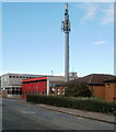
Mobile phone mast next to Patchway Fire Station
Located on Durban Road, adjacent to Patchway Fire Station. http://www.geograph.org.uk/photo/2155614 The mast is 15 metres high (about 49 feet).
Image: © Jaggery Taken: 6 Nov 2010
0.15 miles