IMAGES TAKEN NEAR TO
Cooks Close, BRISTOL, BS32 0BB
Introduction
This page details the photographs taken nearby to Cooks Close, BS32 0BB by members of the Geograph project.
The Geograph project started in 2005 with the aim of publishing, organising and preserving representative images for every square kilometre of Great Britain, Ireland and the Isle of Man.

There are currently over 7.5m images from over14,400 individuals and you can help contribute to the project by visiting https://www.geograph.org.uk
Image Map
Images are licensed for reuse under creativecommons.org/licenses/by-sa/2.0
Notes
- Clicking on the map will re-center to the selected point.
- The higher the marker number, the further away the image location is from the centre of the postcode.
Image Listing (25 Images Found)
Images are licensed for reuse under creativecommons.org/licenses/by-sa/2.0
Image
Details
Distance
1
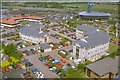
Patchway & RCA Tower
This aerial view of the RAC Tower and the M5 in the distance was taken from a 200ft Cellular Tower within the grounds of the Orange mobile telephone network. (The mast had just been built and was not in service). Thanks due to Orange's Technical Englineering Department for access, and the safety gear!
Image: © Raymond Okonski
Taken: 19 Jun 1994
0.04 miles
2
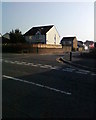
Cooks Close
This is a Cul-de-Sac off Pear Tree Road in Bradley Stoke North.
Image: © Michael Murray
Taken: 20 Sep 2008
0.10 miles
4
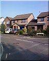
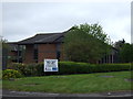
Apseleys Mead
Cul-de-Sac off Pear Tree road Bradley Stoke North.
Image: © Michael Murray
Taken: 20 Sep 2008
0.12 miles
5
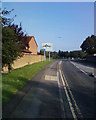
Traffic Sign in Pear Tree road Bradley Stoke
This sign lets you know where the motorway is.
Image: © Michael Murray
Taken: 20 Sep 2008
0.12 miles
6
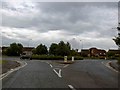
Patchway roundabout
From Great Park Road.
Image: © Steve Fareham
Taken: 7 Jul 2009
0.15 miles
7
Another Bradley Stoke roundabout
In the far background the mast of the RAC centre.
Image: © Steve Fareham
Taken: 6 Jul 2011
0.15 miles
8
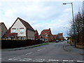
Foxfield Avenue
Looking north up Foxfield from Bowsland Way.The first road on the left just visible is Rush Close
Image: © Nigel Mykura
Taken: 17 Mar 2013
0.15 miles
9
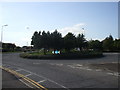
The Peartree Roundabout Woodlands lane
I can only imagine that there once was an orchard here.
Image: © Michael Murray
Taken: 13 Sep 2008
0.16 miles