IMAGES TAKEN NEAR TO
Newbourne Road, WESTON-SUPER-MARE, BS22 8NF
Introduction
This page details the photographs taken nearby to Newbourne Road, BS22 8NF by members of the Geograph project.
The Geograph project started in 2005 with the aim of publishing, organising and preserving representative images for every square kilometre of Great Britain, Ireland and the Isle of Man.

There are currently over 7.5m images from over14,400 individuals and you can help contribute to the project by visiting https://www.geograph.org.uk
Image Map (Loading...)


Getting Data...Please wait
Leaflet Map data © OpenStreetMap
Images are licensed for reuse under creativecommons.org/licenses/by-sa/2.0
Notes
- Clicking on the map will re-center to the selected point.
- The higher the marker number, the further away the image location is from the centre of the postcode.
Image Listing (24 Images Found)
Images are licensed for reuse under creativecommons.org/licenses/by-sa/2.0
Image
Details
Distance
1
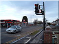
The Locking Road
The Locking Road. Once the main road into Weston Super Mare. Showing one of the two remaining Petrol stations on this B road to the motorway.
Image: © Ant Basterfield
Taken: 16 Feb 2010
0.08 miles
2
The Locking road
Looking along the Locking road at the front of the milk delivery depot.
Image: © Ant Basterfield
Taken: 20 Feb 2010
0.08 miles
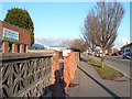
3
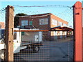
Cycle Path
The Cycle path that runs along side the old Clarks shoe factory looking south
Image: © Ant Basterfield
Taken: 1 Jan 2010
0.08 miles
5
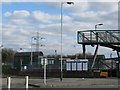
Dairy Crest milk depot
This building has been here for some time. At one time it was Unigate dairies, it's seen here on a quiet Saturday afternoon.
Image: © Ant Basterfield
Taken: 20 Feb 2010
0.11 miles
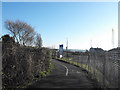
6
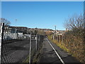
Cycle Path
Cycle Path running next to the site of old Clarks Shoe factory. Worlebury Hill can be seen in the distance.
Image: © Ant Basterfield
Taken: 1 Jan 2010
0.15 miles
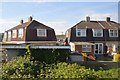
8
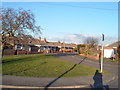
Bungalows in quiet suburb
All these bungalows are well kept in this quiet part of Milton, Weston Super Mare.
Image: © Ant Basterfield
Taken: 20 Feb 2010
0.15 miles
9
Locking Road Weston Super Mare
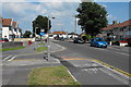
Here on the left of the picture is the junction of Ewart Road with the Locking Road. The right hand junction in the distance is Locking Moor Road. In its heyday as a holiday major resort, a good number of these houses were bed and breakfasts.
Image: © Ant Basterfield
Taken: 23 Jun 2009
0.16 miles
10
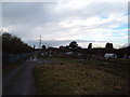
Hutton Moor allotment gardens
Here's the view through the fence looking at the allotments in winter. Though perhaps the Polytunnel could be producing something?
Image: © Ant Basterfield
Taken: 16 Feb 2010
0.17 miles