1
Outdoor tables at the Grapevine
A relatively new pub on the historic part of Mangotsfield.
Image: © Neil Owen
Taken: 24 Jun 2021
0.14 miles
2
Patriotic colours
The Red Lion in Mangotsfield has taken up the challenge of arousing national support in the (delayed) Euro football championships. At this point in time, England had finished top of the group and were headed for a showdown with Germany at Wembley in the first knock-out round.
Image: © Neil Owen
Taken: 24 Jun 2021
0.14 miles
3
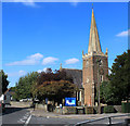
2011 : B4465 Mangotsfield Road, Mangotsfield
St. James Church is to the right.
"The former rural parish of Mangotsfield in south Gloucestershire, was anciently within Kingswood Chase, and originally comprised of what are now the north-east Bristol suburbs of Blackhorse, Bromley Heath, Downend, Emerson’s Green, Mangotsfield, Staple Hill, the eastern part of Oldbury Court and the upper part of Soundwell, and the two remaining rural hamlets of Bury Hill and Moorend. The whole parish, except the Oldbury Court part, remains outside the Bristol city boundary, and has some traces of its rural past.
The history of Mangotsfield stretches back to the Domesday Book of 1086 and almost certainly beyond. The name probably derives from Mangod’s Feld, Mangod being a Saxon word and Feld meaning a stretch of open country, in other words, Mangod’s stretch of open country. Mangotsfield village answers to most people’s idea of a “typical” English village, a nucleated settlement growing up around a medieval church with a manor house next door."
By Andrew Plaster
Published in B&AFHS Journal 125 September 2006
Image: © Maurice Pullin
Taken: 2 Sep 2011
0.14 miles
4
Mangotsfield (Glos) St James Church
Image: © ChurchCrawler
Taken: Unknown
0.15 miles
5
Ornate but functional
The old Dame School building is now blocked with some unusually ornate bars. The space inside is all but empty and open to the elements; a picnic table suggests this may be used as storage.
Image: © Neil Owen
Taken: 24 Jun 2021
0.16 miles
6
A few headstones propped up
The old burial ground has not seen a new resident for well over a century. A few stones line the wall but there is otherwise little to suggest its purpose. It has more the feel of a small public park. There is no church in the immediate vicinity, although the ancient St James is just a short distance up the road.
Image: © Neil Owen
Taken: 24 Jun 2021
0.16 miles
7
Disused and now unnoticed
This small plot of land on St James Street is a former graveyard. It was established as a new ground for the nearby St James church and opened in around 1802 on what used to be the gardens of the old Mangotsfield Workhouse, but was disused by the later nineteenth century and as now largely unrecogniseable. Only a few headstones remain to mark it as a place of rest. Oddly, it has not been reused or built on for well over a century.
Image: © Neil Owen
Taken: 24 Jun 2021
0.16 miles
8
A nod to the learning
An unusual sort of statue: two children reading a book. This monument was created by a former local artist, Tom Whitehead, and cost £15,000; it marks an old entrance to the former Mangotsfield Church of England School that stood along this road from 1876 until 1999. The site remained derelict until deomlition in 2018, whereupon Cotswold Homes built a large housing block on it, and as part of the works paid for this memorial.
Image: © Neil Owen
Taken: 24 Jun 2021
0.16 miles
9
Looking along Burley Grove
Image: © Linda Bailey
Taken: 24 May 2006
0.16 miles
10
Relief on St James Place
A rarity these days - a public convenience, and an open one at that!
Image: © Neil Owen
Taken: 24 Jun 2021
0.16 miles


