2011 : B4465 Mangotsfield Road, Mangotsfield
Introduction
The photograph on this page of 2011 : B4465 Mangotsfield Road, Mangotsfield by Maurice Pullin as part of the Geograph project.
The Geograph project started in 2005 with the aim of publishing, organising and preserving representative images for every square kilometre of Great Britain, Ireland and the Isle of Man.

There are currently over 7.5m images from over 14,400 individuals and you can help contribute to the project by visiting https://www.geograph.org.uk
2011 : B4465 Mangotsfield Road, Mangotsfield
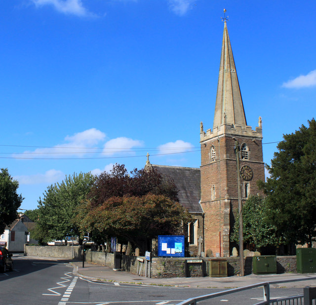
Image: © Maurice Pullin Taken: 2 Sep 2011
St. James Church is to the right. "The former rural parish of Mangotsfield in south Gloucestershire, was anciently within Kingswood Chase, and originally comprised of what are now the north-east Bristol suburbs of Blackhorse, Bromley Heath, Downend, Emerson’s Green, Mangotsfield, Staple Hill, the eastern part of Oldbury Court and the upper part of Soundwell, and the two remaining rural hamlets of Bury Hill and Moorend. The whole parish, except the Oldbury Court part, remains outside the Bristol city boundary, and has some traces of its rural past. The history of Mangotsfield stretches back to the Domesday Book of 1086 and almost certainly beyond. The name probably derives from Mangod’s Feld, Mangod being a Saxon word and Feld meaning a stretch of open country, in other words, Mangod’s stretch of open country. Mangotsfield village answers to most people’s idea of a “typical” English village, a nucleated settlement growing up around a medieval church with a manor house next door." By Andrew Plaster Published in B&AFHS Journal 125 September 2006
Images are licensed for reuse under creativecommons.org/licenses/by-sa/2.0
Image Location
Latitude
51.482938
Longitude
-2.485403