IMAGES TAKEN NEAR TO
Mulberry Gardens, BRISTOL, BS16 4SA

Introduction

This page details the photographs taken nearby to Mulberry Gardens, BS16 4SA by members of the Geograph project.

The Geograph project started in 2005 with the aim of publishing, organising and preserving representative images for every square kilometre of Great Britain, Ireland and the Isle of Man.

There are currently over 7.5m images from over14,400 individuals and you can help contribute to the project by visiting https://www.geograph.org.uk

Image Map


Images are licensed for reuse under creativecommons.org/licenses/by-sa/2.0
Notes
  • Clicking on the map will re-center to the selected point.
  • The higher the marker number, the further away the image location is from the centre of the postcode.

Image Listing (7 Images Found)

Images are licensed for reuse under creativecommons.org/licenses/by-sa/2.0
Image
Details
Distance
1
Soundwell Road
The A4017 passing through Upper Soundwell, close to the site of the Downcast coal pit. The area supplied much-needed fuel for the industries of the Bristol area, but retained an independent spirit; Soundwell Road has several C19 non-conformist chapels.
Image: © Derek Harper Taken: 26 Mar 2010
0.20 miles
2
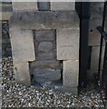
Ordnance Survey Cut Mark
This OS cut mark can be found on the NE angle of the Chapel on Soundwell Road. It marks a point 85.137m above mean sea level.
Image: © Adrian Dust Taken: 19 Jul 2021
0.21 miles
3
Kingswood Leisure Centre
This is in Upper Soundwell, and is off to the right of the foreground of Image It contains a 33 metre swimming pool ("Bristol Areas largest" proclaims the banner) with three diving boards, a sports hall, two squash courts and a gym.
Image: © Derek Harper Taken: 26 Mar 2010
0.22 miles
4
Staple Hill tunnel - west portal
on the Bristol-Bath railway path
Image: © Peter Goodwin Taken: 18 Aug 2006
0.23 miles
5
Staple Hill (Bristol) Railway Station
Image: © Tudor Williams Taken: Unknown
0.23 miles
6
Bristol : Soundwell Road
Near Staple Hill and Kingswood in Bristol.
Image: © Lewis Clarke Taken: 1 Feb 2013
0.24 miles
7
Old railway station now on the Bristol and Bath cycleway
Image: © Rob Purvis Taken: 29 Jun 2023
0.25 miles