1
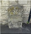
Ordnance Survey Rivet
This OS rivet can be found on the milestone west side of Bishopsworth Road. It marks a point 51.338m above mean sea level.
Image: © Adrian Dust
Taken: 5 Aug 2022
0.05 miles
2
Old Milestone by Bishopsworth Road, Bristol parish
Stone post (plate lost) by the UC road, in parish of BRISTOL (CITY OF BRISTOL District), Bishopsworth Road, Bedminster Down, by No 138, in pavement, back to block wall, on West side of road. Bristol iron plate, erected by the Bristol turnpike trust in the 19th century.
Inscription once read:-
(BRISTOL 2)
(CHEW STOKE 5)
Carved benchmark top right.
Milestone Society National ID: SO_BRWL02.
Image: © M Faherty
Taken: 21 Jul 2011
0.05 miles
3
School kit
Cheddar Grove primary school now has some more equipment to keep the roads clear.
Image: © Neil Owen
Taken: 2 Aug 2014
0.10 miles
4
Draw your own conclusions
Cheddar Grove Primary School is (like many) clogged by cars at leaving time as anxious parents wait for their precious offspring. In order to prevent them from sprawling all over the junction here the local council have installed these fetching bollards. Whether it deters them will be seen.
Image: © Neil Owen
Taken: 2 Aug 2014
0.10 miles
5
Bedminster Down School, Bristol, from Tyntesfield Road
Image: © Trevor Johnson
Taken: 26 Sep 2012
0.12 miles
6
Cheddar Grove
The small grass island is home to some trees, a spread of daffodils and a rather draughty phone box.
Image: © Neil Owen
Taken: 4 Mar 2014
0.12 miles
7
Greeting the parishioners
Some crocuses in front of St Oswald's.
Image: © Neil Owen
Taken: 4 Mar 2014
0.13 miles
8
Order of service
St Oswald's church congregation, with the gulls at the head of the procession.
Image: © Neil Owen
Taken: 4 Mar 2014
0.13 miles
9
Spring triumvirate
A splash of colour to signal the end of winter: daffodils, violets and crocuses.
Image: © Neil Owen
Taken: 4 Mar 2014
0.13 miles
10
St Oswald's
This church may look older but was in fact part of the area's development in the 1920-30s.
Image: © Neil Owen
Taken: 4 Mar 2014
0.14 miles


