IMAGES TAKEN NEAR TO
Oaktree Court, BRISTOL, BS11 0BN

Introduction

This page details the photographs taken nearby to Oaktree Court, BS11 0BN by members of the Geograph project.

The Geograph project started in 2005 with the aim of publishing, organising and preserving representative images for every square kilometre of Great Britain, Ireland and the Isle of Man.

There are currently over 7.5m images from over14,400 individuals and you can help contribute to the project by visiting https://www.geograph.org.uk

Image Map


Images are licensed for reuse under creativecommons.org/licenses/by-sa/2.0
Notes
  • Clicking on the map will re-center to the selected point.
  • The higher the marker number, the further away the image location is from the centre of the postcode.

Image Listing (100 Images Found)

Images are licensed for reuse under creativecommons.org/licenses/by-sa/2.0
  • ...
Image
Details
Distance
1
The Ridge, Shirehampton
Image: © Roger Cornfoot Taken: 9 Dec 2019
0.06 miles
2
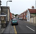
Penpole Avenue, Shirehampton
Looking down Penpole Avenue towards Shirehampton High Street with land to the south of the River Avon stretched away in the distance.
Image: © Stephen McKay Taken: 10 Nov 2010
0.07 miles
3
Penpole Avenue, Shirehampton, Bristol
Viewed from the High Street end.
Image: © Jaggery Taken: 23 Jun 2012
0.08 miles
4
Sedgewick House, Shirehampton
Image: © Roger Cornfoot Taken: 9 Dec 2019
0.08 miles
5
Bungalows and highrise flats, Shirehampton, Bristol
Though now part of Bristol, Shirehampton retains some elements of its former status as a village. I was surprised on turning the corner from High Street into The Ridge to see these two highrise blocks of flats, Barwick House and Sedgewick House.
Image: © Jaggery Taken: 23 Jun 2012
0.09 miles
6
Penpole Avenue, Shirehampton
Image: © Roger Cornfoot Taken: 9 Dec 2019
0.09 miles
7
Penpole Point
A former view point. Is the wall a remnant of the demolished viewing tower or breakfast lodge mentioned in https://historicengland.org.uk/listing/the-list/list-entry/1000335 , or perhaps part of the estate wall?
Image: © Derek Harper Taken: 29 Mar 2014
0.09 miles
8
Foliage on Sedgewick House
The side of the high-rise block has seen many coats of paint in the past, with the present decoration a departure from the linear rectangles and bands.
Image: © Neil Owen Taken: 6 Feb 2023
0.09 miles
9
Ruins of the old lodge
Some remnants of the old Penpole Lodge stand in an open part of the park. In the past people would have entered the path through its arch.
Image: © Neil Owen Taken: 6 Feb 2023
0.10 miles
10
Portway Community School
The school was originally founded in 1932. It has recently been rebuilt.
Image: © Linda Bailey Taken: 2 Mar 2006
0.10 miles
  • ...