IMAGES TAKEN NEAR TO
Windmill Lane, BRISTOL, BS10 7PZ
Introduction
This page details the photographs taken nearby to Windmill Lane, BS10 7PZ by members of the Geograph project.
The Geograph project started in 2005 with the aim of publishing, organising and preserving representative images for every square kilometre of Great Britain, Ireland and the Isle of Man.

There are currently over 7.5m images from over14,400 individuals and you can help contribute to the project by visiting https://www.geograph.org.uk
Image Map
Images are licensed for reuse under creativecommons.org/licenses/by-sa/2.0
Notes
- Clicking on the map will re-center to the selected point.
- The higher the marker number, the further away the image location is from the centre of the postcode.
Image Listing (84 Images Found)
Images are licensed for reuse under creativecommons.org/licenses/by-sa/2.0
Image
Details
Distance
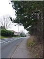
3
Hallen Road, Henbury
The bollards show where the former course of the road used to be, before it was diverted via a junction with Avonmouth Way.
Image: © Derek Harper
Taken: 19 Jan 2014
0.09 miles
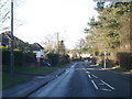
5
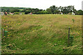
Grass field, Henbury
Looking towards Hallen Road.
Image: © Derek Harper
Taken: 27 Jun 2021
0.11 miles
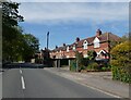
6
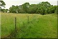
Field and trees by Hallen Road
On the right, footpath BCC/21/30 leads towards Hallen Close. On the left are houses on Hallen Road.
Image: © Derek Harper
Taken: 27 Jun 2021
0.11 miles
7
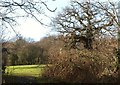
Trees and field by Hallen Close
A detail of the scene in Image], showing the way into the field beside which footpath BCC/21/30 runs. In the background is Moorgrove Wood.
Image: © Derek Harper
Taken: 19 Jan 2014
0.12 miles
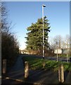
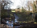
8
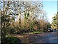
Footpath leaving Hallen Close, Henbury
Footpath BCC/21/30 leads to Woodgrove Road. Hallen Close follows the former course of Hallen Road, which is now diverted to a junction with Avonmouth Way; bollards in the background block the way for cars.
Image: © Derek Harper
Taken: 19 Jan 2014
0.12 miles
9
Footpath from Hallen Close, Henbury
Footpath BCC/21/30 goes round the barrier to the right before heading off towards Woodgrove Road.
Image: © Derek Harper
Taken: 19 Jan 2014
0.12 miles
10
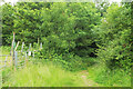
Path approaching Hallen Close, Henbury
This is footpath BCC/21/30 entering the belt of trees along the west side of the cul-de-sac.
Image: © Derek Harper
Taken: 27 Jun 2021
0.12 miles