IMAGES TAKEN NEAR TO
Azalea Drive, SWANLEY, BR8 8HX
Introduction
This page details the photographs taken nearby to Azalea Drive, BR8 8HX by members of the Geograph project.
The Geograph project started in 2005 with the aim of publishing, organising and preserving representative images for every square kilometre of Great Britain, Ireland and the Isle of Man.

There are currently over 7.5m images from over14,400 individuals and you can help contribute to the project by visiting https://www.geograph.org.uk
Image Map (Loading...)


Getting Data...Please wait
Leaflet Map data © OpenStreetMap
Images are licensed for reuse under creativecommons.org/licenses/by-sa/2.0
Notes
- Clicking on the map will re-center to the selected point.
- The higher the marker number, the further away the image location is from the centre of the postcode.
Image Listing (74 Images Found)
Images are licensed for reuse under creativecommons.org/licenses/by-sa/2.0
Image
Details
Distance
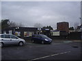
1
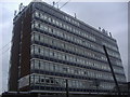
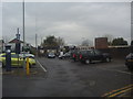
Office block on Station Approach, Swanley
Image: © David Howard
Taken: 8 Apr 2012
0.04 miles
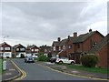
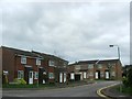
4
Goldsel Road Swanley at the junction of Azalea Drive
Image: © David Howard
Taken: 8 Apr 2012
0.05 miles
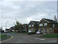
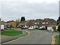
6
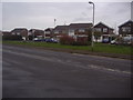
Houses on Leyhill Close by Goldsel Road, Swanley
These are typical 1970s houses
Image: © David Howard
Taken: 8 Apr 2012
0.06 miles