IMAGES TAKEN NEAR TO
St. Pauls Cray Road, CHISLEHURST, BR7 6QE
Introduction
This page details the photographs taken nearby to St. Pauls Cray Road, BR7 6QE by members of the Geograph project.
The Geograph project started in 2005 with the aim of publishing, organising and preserving representative images for every square kilometre of Great Britain, Ireland and the Isle of Man.

There are currently over 7.5m images from over14,400 individuals and you can help contribute to the project by visiting https://www.geograph.org.uk
Image Map
Images are licensed for reuse under creativecommons.org/licenses/by-sa/2.0
Notes
- Clicking on the map will re-center to the selected point.
- The higher the marker number, the further away the image location is from the centre of the postcode.
Image Listing (41 Images Found)
Images are licensed for reuse under creativecommons.org/licenses/by-sa/2.0
Image
Details
Distance
3
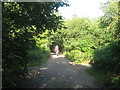
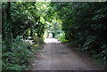
The Drive, Scadbury Park
This is a private access road leading from St Paul's Cray Road towards Park Wood House and Scadbury Cottages.
Part of it is also used by the London Outer Orbital Path (Loop) heading through the park towards Sidcup.
Image: © David Anstiss
Taken: 24 Jul 2011
0.11 miles
4
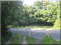
London Loop crosses St Paul's Cray Road
The London Outer Orbital Path (Loop) heads from Petts Wood towards the Drive heading through Scadbury Park.
Image: © David Anstiss
Taken: 24 Jul 2011
0.11 miles
5
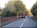
Manor Park Road at the junction of St Paul's Cray Road
Image: © David Howard
Taken: 25 Oct 2015
0.12 miles
6
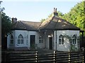
The Lodge, Scadbury Park
Grade II listed lodge house on the Drive of the Park.
See http://www.britishlistedbuildings.co.uk/en-358571-lodge-to-scadbury-park-bromley for more details about the building.
Image: © David Anstiss
Taken: 24 Jul 2011
0.12 miles
7
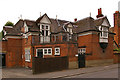
Grange Cottage, St Paul's Cray Road
Dating from 1880 and designed by George Somers Leigh Clarke, this house is grade II listed - for listing particulars see www.historicengland.org.uk/listing/the-list/list-entry/1186791.
Image: © Ian Capper
Taken: 28 Jul 2009
0.14 miles
8
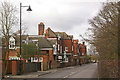
St Paul's Cray Road
An impressive range of houses on the west side of the road, all designed by George Somers Leigh Clarke. The nearest is Grange Cottage, dating from around 1880, then three similar but asymmetric houses, each with its own name and date plaque, showing a building date of 1878: in order they are Crayfield, Cleeveland and Warren House.
All are grade II listed - for listing particulars of Grange Cottage see www.historicengland.org.uk/listing/the-list/list-entry/1186791 and for the other three, which are jointly listed, see www.historicengland.org.uk/listing/the-list/list-entry/1204429.
Image: © Ian Capper
Taken: 9 Feb 2010
0.14 miles