
IMAGES TAKEN NEAR TO
Sevenoaks Road, ORPINGTON, BR6 9JJ
Introduction
This page details the photographs taken nearby to Sevenoaks Road, BR6 9JJ by members of the Geograph project.
The Geograph project started in 2005 with the aim of publishing, organising and preserving representative images for every square kilometre of Great Britain, Ireland and the Isle of Man.

There are currently over 7.5m images from over14,400 individuals and you can help contribute to the project by visiting https://www.geograph.org.uk
Image Map
Images are licensed for reuse under creativecommons.org/licenses/by-sa/2.0
Notes
- Clicking on the map will re-center to the selected point.
- The higher the marker number, the further away the image location is from the centre of the postcode.
Image Listing (205 Images Found)
Images are licensed for reuse under creativecommons.org/licenses/by-sa/2.0
Image
Details
Distance
1
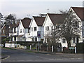
The Drive
A road developed soon after the first world war, connecting Sevenoaks Road with Station Road
Image: © Ian Capper
Taken: 12 Feb 2009
0.02 miles
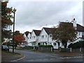
3
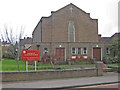
Orpington Methodist Church
In Sevenoaks Road, just south of the town centre
Image: © Ian Capper
Taken: 28 Nov 2007
0.04 miles
4
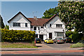
8-10 Sevenoaks Road
Pair of houses in Sevenoaks Road, built in the 1910s or so.
Image: © Ian Capper
Taken: 22 May 2012
0.04 miles
5
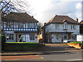
Orpington Conservative Association
This photo has been submitted to demonstrate political impartiality - see Image for the Liberal Club.
Image: © Ian Capper
Taken: 29 Nov 2007
0.05 miles
7
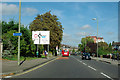
Approaching Orpington town centre
The bus ahead is Metrobus fleet number 517 on route 358. It has just pulled away from Orpington War Memorial bus stop.
Image: © Robin Webster
Taken: 27 Sep 2011
0.06 miles
8
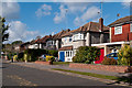
The Avenue
The continuation of Park Avenue (see Image) over Sevenoaks Road.
Image: © Ian Capper
Taken: 16 Oct 2012
0.06 miles
10
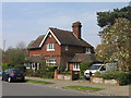
The Lodge, Park Avenue
Old maps and photos show the present Park Avenue as the access route to Goddington, the other side of the present route of Court Road, the A224 Orpington bypass. It also extended the other side of Sevenoaks Road towards Orpington Station, along the route of a road still known as "The Avenue" (see Image). The maps date this route as being from the late 19th century.
The same maps and photos show this building, "The Lodge", on this route, at the junction of the present Park Avenue and Sevenoaks Road, predating the development of much of Sevenoaks Road, with the clear impression that this was the lodge for Goddington.
Image: © Ian Capper
Taken: 22 Apr 2008
0.07 miles