IMAGES TAKEN NEAR TO
Court Road, ORPINGTON, BR6 9BY
Introduction
This page details the photographs taken nearby to Court Road, BR6 9BY by members of the Geograph project.
The Geograph project started in 2005 with the aim of publishing, organising and preserving representative images for every square kilometre of Great Britain, Ireland and the Isle of Man.

There are currently over 7.5m images from over14,400 individuals and you can help contribute to the project by visiting https://www.geograph.org.uk
Image Map (Loading...)


Getting Data...Please wait
Leaflet Map data © OpenStreetMap
Images are licensed for reuse under creativecommons.org/licenses/by-sa/2.0
Notes
- Clicking on the map will re-center to the selected point.
- The higher the marker number, the further away the image location is from the centre of the postcode.
Image Listing (38 Images Found)
Images are licensed for reuse under creativecommons.org/licenses/by-sa/2.0
Image
Details
Distance
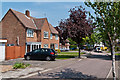
1
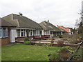
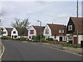
Bungalows
One of a number of bungalow developments in Orpington. These are alongside the 1920s built Orpington bypass, Court Road.
Image: © Ian Capper
Taken: 11 Feb 2009
0.04 miles
2
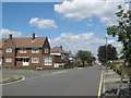
Woodley Road
1950s housing in an area off Avalon Road.
Image: © Ian Capper
Taken: 22 May 2012
0.05 miles
3
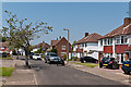
Poynings Close
1950s cul de sac off Pendennis Road, in an area off Avalon Road.
Image: © Ian Capper
Taken: 22 May 2012
0.10 miles
4
Court Road from the Spur Road junction
Court Road is the Orpington bypass, heading north through St Marys Cray and beyond.
Image: © David Howard
Taken: 12 Feb 2012
0.10 miles
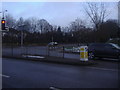
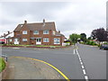
5
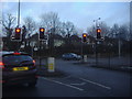
Spur Road at the junction of Court Road
Image: © David Howard
Taken: 12 Feb 2012
0.11 miles
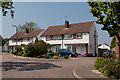
6
Felstead Road
One of a number of roads in this part of Orpington named after public schools. Felstead Road was started to be developed between the wars, partly along the route of what a 1920s map shows as the footpath leading from All Saints Church to Goddington. A group of houses in the road are of an unusual "dutch barn" design, as shown here.
Image: © Ian Capper
Taken: 25 Apr 2008
0.11 miles
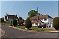
7
Road junction on Felsted Road
Felstead Road leads from Park Avenue down to Spur Road.
Hillcrest Road leads left towards Sevenoaks Road.
Image: © David Anstiss
Taken: 24 Jul 2011
0.11 miles
8
Pendennis Road
1950s housing in an area off Avalon Road.
Image: © Ian Capper
Taken: 22 May 2012
0.11 miles
9
Woodley Road
1950s housing in an area off Avalon Road.
Image: © Ian Capper
Taken: 22 May 2012
0.11 miles
10
The junction of Hillcrest and Felstead Roads
See also http://www.geograph.org.uk/photo/2532115 from 2011.
Image: © Shazz
Taken: 30 Jul 2016
0.11 miles